Disclosure : This site contains affiliate links to products. We may receive a commission for purchases made through these links.
Bathgate
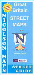
Bathgate street map from Nicolson Maps: coverage includes Blackburn, Boghall, Broxburn, Kirkliston, Newbridge, South Queensferry, Ratho, Ratho Station and Uphall. Nicolson Maps, Scotland’s premier cartographic publisher, provides an extensive series of titles covering mainly Scottish towns plus some in Cumbria, Northumberland and Tyne & Wear. Most Nicolson’s street maps are double-sided and in addition to the town(s) shown in the map title cover on separate panels smaller nearby towns, each with a street index ‘“ please see each title’s individual description for a full list of towns covered by it.The plans indicate, usually by different colours, primary routes plus A and B roads. Symbols highlight various facilities, such as emergency services, schools, libraries, bus stations, places of worship, car parks and petrol stations, as well as camping and caravan sites, historic buildings, tourist information points and other places of interest.

Related Products:
 Clydebank
 Cumbernauld Street Guide
Grangemouth
Cumbernauld Street Guide
Grangemouth
 Great Britain: Nicolson Street Guide Maps
Auchterarder
Newton Mearns
Kelso
Haddington
Musselburgh
Kinross
Huntly
Beith and Johnstone
Fraserburgh and Turriff
Glasgow Nicolson Street Plan
Renfrew
Penicuik
Thurso, Wick and Helmsdale
Stirling, Bannockburn and Bridge of Allan
Great Britain: Nicolson Street Guide Maps
Auchterarder
Newton Mearns
Kelso
Haddington
Musselburgh
Kinross
Huntly
Beith and Johnstone
Fraserburgh and Turriff
Glasgow Nicolson Street Plan
Renfrew
Penicuik
Thurso, Wick and Helmsdale
Stirling, Bannockburn and Bridge of Allan
 Falkirk, Cumbernauld & Livingstone – Linlithgow, Bathgate & Kilsyth OS Explorer Map 349 (paper)
 Falkirk, Cumbernauld & Livingston – Linlithgow, Bathgate & Kilsyth OS Explorer 349 (waterproof)
 Waikato Towns and District Pathfinder
 London: Future Mapping Company Wall Maps with Cycling Routes
 Northland: Whangarei, Bay of Islands and 61 Provincial Towns Pathfinder
 Rotorua and Taupo Pathfinder
 Coromandel Pocket Map
 Dunedin, Mosgiel, Oamaru and Otago Towns Pocket Map
 Kurzeme North Jana Seta Tourist Map
 New Plymouth and Taranaki Towns Pocket Map
 Tauranga – Bay of Plenty Pathfinder
 Palmerston North Pathfinder
 Hamilton, Cambridge, Te Awamutu Pocket Map
 Jujuy and Salta Provinces
 Whangaparaoa and Orewa Pocket Map
 Latgale South Jana Seta Tourist Map
 Napier, Hastings and Hawke`s Bay Pathfinder
 Vidzeme North Jana Seta Tourist Map
 Wellington City and District Pathfinder
 Kurzeme South Jana Seta Tourist Map
 Central Latvia Jana Seta Tourist Map