Disclosure : This site contains affiliate links to products. We may receive a commission for purchases made through these links.
Bath, Marshfield and the Vale of Avon 1912
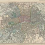
Bath, Marshfield and the Vale of Avon in 1912 in a series of reproductions of Ordnance Survey’s famous “Inch to the Mile” maps published in the Alan Godfrey Editions to provide a historical record of England and Wales in the second half of 19th and early 20th century.The map covers the area around and to the north and east of Bath, stretching from Oldland and Mangotsfield eastward to Chippenham, and from Old Sodbury southward to Melksham. Other locations include: in GLOUCESTERSHIRE Acton Turville, Bitton, Coalpit Heath, Cold Ashton, Dodington, Doynton, Dyrham and Hinton, Frampton Cotterell, Marshfield, Pucklechurch, Siston, Thormarton, Wapley and Codrington, West Littleton, and Westerleigh; in SOMERSET Bathampton, Batheaston, Bathford, Burnett, Charlcombe, Claverton, Corston, English Combe, Kelston, Langridge, Newton St Loe, North Stoke, Saltford, St Catherine, Stanton Prior, Swainswick, Twerton, Weston, and Woolley; plus in WILTSHIRE Atworth, Biddestone, Box, Broughton Gifford, Castle Combe, Colerne, Corsham, Draycot Cerne, Grittleton, Hardenhuish, Kington Langley, Kington St Michael, Lacock, Leigh Delamere, Littleton Drew, Monkton Farleigh, Nettleton, North Wraxall, Slaughterford, South Wraxall, Stanton St Quintin, Sutton Benger, West Kington and Yatton Keynell. On the reverse is a detailed map of Marshfield. About the Alan Godfrey Editions of the OS Inch to the Mile Maps: the maps provide an invaluable overview of a wider area, typically 18 x 12 miles (29 x 19 kms approx.), and offer historical mapping for small towns and villages not covered by the more detailed series for which the Godfrey Editions are better known. On the reverse all the maps have historical notes and most titles also include a more detailed, large scale map of a small town or a village in the area.To see other titles in this series please click on the series link.

Related Products:
 Bristol and District 1912
 Bristol & Bath – Keynsham & Marshfield OS Explorer Active Map 155 (waterproof)
The Blackmore Vale 1903
Bristol & Bath – Keynsham & Marshfield OS Explorer Active Map 155 (waterproof)
The Blackmore Vale 1903
 Bristol & Bath – Keynsham & Marshfield OS Explorer Map 155 (paper)
North East Essex and Dedham Vale 1904
Bristol & Bath – Keynsham & Marshfield OS Explorer Map 155 (paper)
North East Essex and Dedham Vale 1904
 Wylam and Clara Vale 1895
Welshpool and District 1904-1912
Vale of White Horse 1893
Vale of Pickering 1904
Wylam and Clara Vale 1895
Welshpool and District 1904-1912
Vale of White Horse 1893
Vale of Pickering 1904
 Ebbw Vale (South) 1899 – 11.14
Jarrow 1912
Ebbw Vale (South) 1899 – 11.14
Jarrow 1912
 Ebbw Vale North 1899
St Anthonys and Bill Quay 1912
The Mendips 1897 – 280
North West Surrey 1888
Ebbw Vale North 1899
St Anthonys and Bill Quay 1912
The Mendips 1897 – 280
North West Surrey 1888
 Brentford 1912 – 83.3
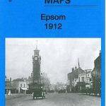 Epsom 1912
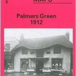 Palmers Green 1912 – 7.14a
Melton Mowbray & District 1912 – 142
Wood Green 1912 – 7.3
Hampton Court & East Molesey 1912 – 12.13
Palmers Green 1912 – 7.14a
Melton Mowbray & District 1912 – 142
Wood Green 1912 – 7.3
Hampton Court & East Molesey 1912 – 12.13
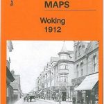 Woking 1912 – 17.09
North Kent Coast 1878
Andover, Whitchurch and the Hampshire Downs 1898
North Tynedale 1902 – 13
North West Gloucestershire 1896
Woking 1912 – 17.09
North Kent Coast 1878
Andover, Whitchurch and the Hampshire Downs 1898
North Tynedale 1902 – 13
North West Gloucestershire 1896
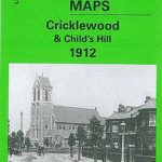 Cricklewood and Child`s Hill 1912
 Gospel Oak 1912 – 28.2
North Dartmoor and Mid-Devon 1887
Penzance and St Ives Bay 1888
Isle of Thanet 1893 – 274
Surbiton & Long Ditton 1912 – 12.08
Ripon, Thirsk and District 1891
Redesdale 1866
Dartmoor 1908
Montgomery and District 1908
Foulness and Mersea 1904
Flodden Field & North Cheviots 1901 – 3
Gospel Oak 1912 – 28.2
North Dartmoor and Mid-Devon 1887
Penzance and St Ives Bay 1888
Isle of Thanet 1893 – 274
Surbiton & Long Ditton 1912 – 12.08
Ripon, Thirsk and District 1891
Redesdale 1866
Dartmoor 1908
Montgomery and District 1908
Foulness and Mersea 1904
Flodden Field & North Cheviots 1901 – 3
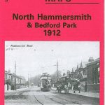 North Hammersmith and Bedford Park 1912