Disclosure : This site contains affiliate links to products. We may receive a commission for purchases made through these links.
Bath – Bradford-on-Avon – Trowbridge A-Z Street Atlas
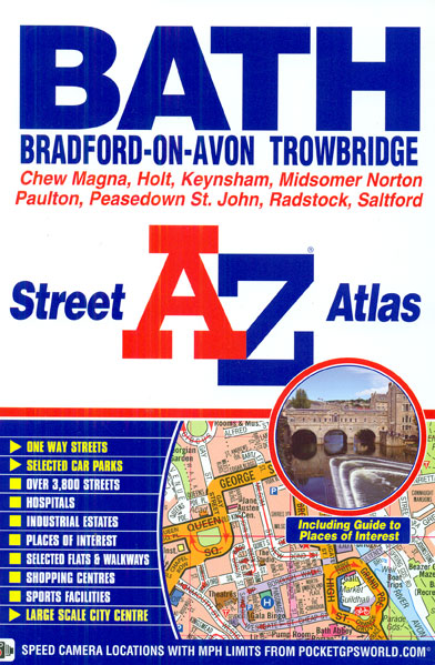
Bath, Bradford-on-Avon and Trowbridge Street Atlas from the Geographers` A-Z Map Company in an A5 paperback format at 1:15,840 (4″ to a mile), with an enlargement showing the town centre of Bath at 1:7,920 (8″ to 1 mile). Coverage includes Chew Magna, Holt, Keynsham, Midsomer Norton, Paulton, Peasedown St. John, Radstock and Saltford. Current edition of this title was published in 2014.To see other titles in this series of A-Z street atlases of towns and cities please click on the series link. A-Z also publish a series of County Street Atlases, for a list of titles in that series please search for SI00000917.A-Z street atlases present motorways plus A and B roads highlighted by colouring and shown with route numbers. One way or restricted access streets and car parks are marked, as are in more recently published titles locations of speed cameras. Also shown are selected cycleway routes. Where appropriate, A and B roads are annotated with selected house numbers for easier identification of addresses. Railway lines are shown with stations and level crossings. Colouring indicates different types of buildings: educational, hospitals and healthcare, industrial, leisure and recreational, shopping centres and markets, public buildings, and places of interest. Symbols mark locations of facilities usually indicated on street mapping: post offices, emergency services, public toilets, etc. Also marked are postcode and local authority boundaries. Each page has the lines and coordinates of the British National Grid. The indexes list streets, places and areas, hospitals, industrial estates, blocks of flats on housing estates, railway stations, and selected places o interest; the latter are printed in contrasting colouring to make them easier to find.


