Disclosure : This site contains affiliate links to products. We may receive a commission for purchases made through these links.
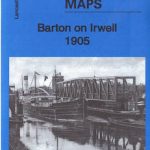
Barton upon Irwell 1888

Barton upon Irwell in 1888 in a fascinating series of reproductions of old Ordnance Survey plans in the Alan Godfrey Editions, ideal for anyone interested in the history of their neighbourhood or family. The map covers Barton upon Irwell, extending southward to Bromyhurst and Dumplington, westward to the cemetery and northward to Patricroft Bridge. The River Irwell runs through the map and is crossed by the Bridgewater Canal. Features include St Catherine`s church, All Saints RC church, Barton Bridge, Mee`s Farm, Victoria Mills, Springfield Mills, Nassau Mills, Grapes Inn, wharfs, Barton Old Hall site, Barton New Hall, Salteye Orchards, Peel Green, etc. On the reverse is an extract from the 1845 OS 6″ to the mile map, covering the area around Eccles, Patricroft, Trafford Hall and Barton upon Irwell.About the Alan Godfrey Editions of the 25″ OS Series:Selected towns in Great Britain and Ireland are covered by maps showing the extent of urban development in the last decades of the 19th and early 20th century. The plans have been taken from the Ordnance Survey mapping and reprinted at about 15 inches to one mile (1:4,340). On the reverse most maps have historical notes and many also include extracts from contemporary directories. Most maps cover about one mile (1.6kms) north/south, one and a half miles (2.4kms) across; adjoining sheets can be combined to provide wider coverage.FOR MORE INFORMATION AND A COMPLETE LIST OF ALL AVAILABLE TITLES PLEASE CLICK ON THE SERIES LINK.

Related Products:
 Barton on Irwell 1905 – 103.11b
 Patricroft and Monton 1905
 Exeter 1888 – 80.06a Colour Edition
 Mesty Croft 1888
Holmfirth 1904
Mesty Croft 1888
Holmfirth 1904
 Cheadle and Cheadle Heath 1897
North Chorley 1909 – 77.08
Hopwood Hall and Thornham 1907
Willenhall & Darlaston Green 1888 – 63.09a
Bishop Middleham & Mainsforth Hall 1896 – 35.15
Lostock Hall and Farington North 1909
Boothstown and Astley Green 1904
Cheadle and Cheadle Heath 1897
North Chorley 1909 – 77.08
Hopwood Hall and Thornham 1907
Willenhall & Darlaston Green 1888 – 63.09a
Bishop Middleham & Mainsforth Hall 1896 – 35.15
Lostock Hall and Farington North 1909
Boothstown and Astley Green 1904
 Bradford Odsal & Low Moor 1905
 New Hartley and Delaval Hall 1896
 Heckmondwike 1905
 Staincliffe and Batley Carr 1892
 Lostock Junction 1907
Wrexham West 1909
Abram 1905
Lostock Junction 1907
Wrexham West 1909
Abram 1905
 Bollington 1907
 Pendleton North 1915
 Bolton 1908 – 87.13b
Redditch East 1903
Accrington 1909
Carshalton & North Wallington 1910 – 13.12
Cockermouth 1898
Bolton 1908 – 87.13b
Redditch East 1903
Accrington 1909
Carshalton & North Wallington 1910 – 13.12
Cockermouth 1898
 Tong 1905
Penzance and St Ives Bay 1888
Marsden 1904
Tong 1905
Penzance and St Ives Bay 1888
Marsden 1904
 Hunmanby 1926
Pedmore 1921
Hunmanby 1926
Pedmore 1921
 Tottington 1908
 Cambridge (North) 1901 – 40.14
 Bromley South 1895
Ivybridge 1905
Bridport 1901
Westhoughton 1907
Bromley South 1895
Ivybridge 1905
Bridport 1901
Westhoughton 1907
 Peebles 1906 – 13.06
 Hanging Heaton 1892
Knutsford South 1908
Hanging Heaton 1892
Knutsford South 1908