Disclosure : This site contains affiliate links to products. We may receive a commission for purchases made through these links.
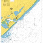
Barry 1898 – 50.04a

Barry in 1898 in a fascinating series of reproductions of old Ordnance Survey plans in the Alan Godfrey Editions, ideal for anyone interested in the history of their neighbourhood or family. Two versions have been published for this area. The maps cover much of the town of Barry which sprang up rapidly after 1884 as a coal exporting port. Coverage stretches from Pontypridd Road and Salisbury Road eastward to Morel Street and George Street, and from North Walk southward to the No. 1 Dock. The northern part of the No.1 Dock is shown with detail including a dozen of the coal hoists, with railway sidings and even including mooring posts. Other features include GWR General Offices, locomotive repairing works, Jenner Park football ground, municipal buildings, Memorial Hall, Glamorgan Training College, Alexandra Gardens, St Paul`s church and many streets of housing. Each map has extracts from a 1906 directory. About the Alan Godfrey Editions of the 25″ OS Series:Selected towns in Great Britain and Ireland are covered by maps showing the extent of urban development in the last decades of the 19th and early 20th century. The plans have been taken from the Ordnance Survey mapping and reprinted at about 15 inches to one mile (1:4,340). On the reverse most maps have historical notes and many also include extracts from contemporary directories. Most maps cover about one mile (1.6kms) north/south, one and a half miles (2.4kms) across; adjoining sheets can be combined to provide wider coverage.FOR MORE INFORMATION AND A COMPLETE LIST OF ALL AVAILABLE TITLES PLEASE CLICK ON THE SERIES LINK.

Related Products:
 Wallasey Village 1898
 Alston 1898
 Goole 1905
 Kidsgrove 1898
 Darlington (South) 1898 – 55.10a
Newbury 1898 – 43.01
Darlington (South) 1898 – 55.10a
Newbury 1898 – 43.01
 Swansea 1897 – 24.05
Darlington West 1898
Annan 1898
Swansea 1897 – 24.05
Darlington West 1898
Annan 1898
 Rotherhithe 1894 – 78.2
 Rotherhithe 1914 – 78.3
 Falkirk 1898
West Hartlepool 1914 – 37.11c
Falkirk 1898
West Hartlepool 1914 – 37.11c
 Rotherhithe 1868 – 78.1
Rock Ferry and New Ferry 1898
Rotherhithe 1868 – 78.1
Rock Ferry and New Ferry 1898
 Hull (Hessle Road) 1928 – 240.06b
Bidston 1898
Oban 1898 – 98.07
Hull (Hessle Road) 1928 – 240.06b
Bidston 1898
Oban 1898 – 98.07
 Newcastle-under-Lyme 1898 – 17.04b
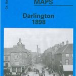 Darlington 1898 – 55.06a
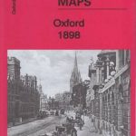 Oxford 1898 – 33.15
South Oxford 1898 – 39.03
Keswick 1898
Oxford 1898 – 33.15
South Oxford 1898 – 39.03
Keswick 1898
 Hull Alexandra Dock 1908
Belfast North 1920
Duns & Greenlaw 1898 – 16.07
Friern Barnet and New Southgate 1898
Hull Alexandra Dock 1908
Belfast North 1920
Duns & Greenlaw 1898 – 16.07
Friern Barnet and New Southgate 1898
 Canning Town & Custom House 1894 – 66.2
 Canning Town & Custom House 1914 – 66.3
Eyemouth 1898 – 6.13
Canning Town & Custom House 1914 – 66.3
Eyemouth 1898 – 6.13
 Kirkdale 1906
Poplar 1894 – 65.2
Kirkdale 1906
Poplar 1894 – 65.2
 Poplar 1914 – 65.3
Bootle Docks & Seaforth 1907 – 99.13
Central Glasgow 1934 – 6.10c
Central Glasgow 1893 – 6.10a
Hull (East) 1908 – 240.03b
Central Glasgow 1909 – 6.10b
Poplar 1914 – 65.3
Bootle Docks & Seaforth 1907 – 99.13
Central Glasgow 1934 – 6.10c
Central Glasgow 1893 – 6.10a
Hull (East) 1908 – 240.03b
Central Glasgow 1909 – 6.10b
 Central Liverpool 1906 – 106.14b
 Bermondsey & Wapping 1872 – 77.1