Disclosure : This site contains affiliate links to products. We may receive a commission for purchases made through these links.
Barnsley North East 1904

Barnsley North East in 1904 in a fascinating series of reproductions of old Ordnance Survey plans in the Alan Godfrey Editions, ideal for anyone interested in the history of their neighbourhood or family. The map covers the north east area of Barnsley, continuing north to Monk Bretton and eastward to Burton Grange. Features include the Dearne & Dove Canal, Littleworth, Days Croft, remains of Monk Bretton priory, Hoyle Mill, Aire & Calder Navigation, Old Mill, Holgate House, glass works, Dearne Paper Works, section of GCR with Oakwell Junction, section of MR Cudworth & Barnsley line, Barnsley Main Colliery, Oak Well Brewery, Beevor Works, St Paul`s church Monk Bretton, football ground, etc. On the reverse are street directory entries for Harborough Hill Rd, Old Mill Lane, Vernon St and Hoyle Mill together with an Inch to the Mile map of 1878 covering the Barnsley area from Silkstone eastward to Darfield.About the Alan Godfrey Editions of the 25″ OS Series:Selected towns in Great Britain and Ireland are covered by maps showing the extent of urban development in the last decades of the 19th and early 20th century. The plans have been taken from the Ordnance Survey mapping and reprinted at about 15 inches to one mile (1:4,340). On the reverse most maps have historical notes and many also include extracts from contemporary directories. Most maps cover about one mile (1.6kms) north/south, one and a half miles (2.4kms) across; adjoining sheets can be combined to provide wider coverage.FOR MORE INFORMATION AND A COMPLETE LIST OF ALL AVAILABLE TITLES PLEASE CLICK ON THE SERIES LINK.

Related Products:
 Barnsley South East 1904
Monk Bretton & Smithies 1904 – 274.04
Barnsley 1904
Barnsley South 1904
Barnsley South East 1904
Monk Bretton & Smithies 1904 – 274.04
Barnsley 1904
Barnsley South 1904
 Cudworth 1904
Barnsley 1890 (Colour Edition)
Cudworth 1904
Barnsley 1890 (Colour Edition)
 Hull North East 1908
 North East Essex and Dedham Vale 1904
Glasgow North East 1893
Willenhall North East 1885
Worcester North-East 1902
North East Essex and Dedham Vale 1904
Glasgow North East 1893
Willenhall North East 1885
Worcester North-East 1902
 Northwich North East 1908
Carlisle North-East 1924
Royston 1904
Bolton upon Dearne 1901
Leeds Central and North East 1890
Horwich North 1907
Northwich North East 1908
Carlisle North-East 1924
Royston 1904
Bolton upon Dearne 1901
Leeds Central and North East 1890
Horwich North 1907
 Bolton North 1908
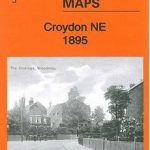 Croydon North-East 1895
 Dearne Valley & Barnsley 1908-13 – 87
East Ham & Barking 1915 – 44.3
Stockton (North) 1899 – 50.12a
North Chorley 1909 – 77.08
Dearne Valley & Barnsley 1908-13 – 87
East Ham & Barking 1915 – 44.3
Stockton (North) 1899 – 50.12a
North Chorley 1909 – 77.08
 Bromley Common and North-East Hayes 1895
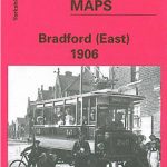 Bradford East 1906
Redditch East 1903
Bradford East 1906
Redditch East 1903
 Pendleton North 1915
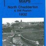 Chadderton North 1932
Gateshead East 1895
Chadderton North 1932
Gateshead East 1895
 Bury North 1908
Boothstown and Astley Green 1904
Glasgow East End 1893
Coventry (West) 1904-11 – 21.11
Bangor East 1901
Motherwell (North) 1939 – 12.09
Bury North 1908
Boothstown and Astley Green 1904
Glasgow East End 1893
Coventry (West) 1904-11 – 21.11
Bangor East 1901
Motherwell (North) 1939 – 12.09
 Stockport East 1897
Holmfirth 1904
Maldon (East) 1920 – 56.13
Hurst and North Ashton 1906
Motherwell (East) 1897 – 12.14
Stockport East 1897
Holmfirth 1904
Maldon (East) 1920 – 56.13
Hurst and North Ashton 1906
Motherwell (East) 1897 – 12.14