Disclosure : This site contains affiliate links to products. We may receive a commission for purchases made through these links.
Barnoldswick 1907
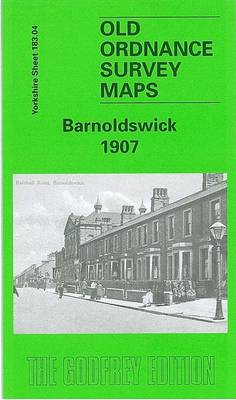
Barnoldswick in 1907 in a fascinating series of reproductions of old Ordnance Survey plans in the Alan Godfrey Editions, ideal for anyone interested in the history of their neighbourhood or family. The map covers Barnoldswick, a small Yorkshire mill town which since council reorganization is now in Lancashire. The Barnoldswick Branch of the Midland Railway travels from the south-east of the map into the town, with its station being close to Foresters Buildings. Butts Mill and Calf Hall Shed are in the centre of the map, east of Higher Calf Hall. Other points of interest include Clough Mills, Moss & Long Ing Shed and Well House Mill. On the reverse side are extracts from a contemporary directory, plus the Midland Railway Timetable 1916,About the Alan Godfrey Editions of the 25″ OS Series:Selected towns in Great Britain and Ireland are covered by maps showing the extent of urban development in the last decades of the 19th and early 20th century. The plans have been taken from the Ordnance Survey mapping and reprinted at about 15 inches to one mile (1:4,340). On the reverse most maps have historical notes and many also include extracts from contemporary directories. Most maps cover about one mile (1.6kms) north/south, one and a half miles (2.4kms) across; adjoining sheets can be combined to provide wider coverage.FOR MORE INFORMATION AND A COMPLETE LIST OF ALL AVAILABLE TITLES PLEASE CLICK ON THE SERIES LINK.

Related Products:
 Bollington 1907
 Heywood 1907
 Hopwood Hall and Thornham 1907
Westhoughton 1907
Horwich North 1907
Hopwood Hall and Thornham 1907
Westhoughton 1907
Horwich North 1907
 Newport 1907 – 95.02
Accrington 1909
Blackrod 1907
Newport 1907 – 95.02
Accrington 1909
Blackrod 1907
 Chorley 1909
Wigan 1907 – 93.08b
Barnsley 1904
Barnsley 1890 (Colour Edition)
Chorley 1909
Wigan 1907 – 93.08b
Barnsley 1904
Barnsley 1890 (Colour Edition)
 Bootle 1907
Lostock Hall and Farington North 1909
Bootle 1907
Lostock Hall and Farington North 1909
 Lostock Junction 1907
Loughborough 1901
Lostock Junction 1907
Loughborough 1901
 Sevenoaks South 1907
 Stockport East 1897
Eyemouth 1898 – 6.13
Stockport East 1897
Eyemouth 1898 – 6.13
 Uckfield 1908
Brampton 1924
Horbury 1905
Uckfield 1908
Brampton 1924
Horbury 1905
 Workington South 1923
Lifford and Bournville 1903
Workington South 1923
Lifford and Bournville 1903
 Bromley South 1895
Nottingham (South) 1899 – 42.06b
Alloa 1899
Wick 1905
Boothstown and Astley Green 1904
Blackburn 1929
Blackburn 1910
Bromley South 1895
Nottingham (South) 1899 – 42.06b
Alloa 1899
Wick 1905
Boothstown and Astley Green 1904
Blackburn 1929
Blackburn 1910
 Hayes 1907
North Chorley 1909 – 77.08
Hayes 1907
North Chorley 1909 – 77.08
 Sevenoaks North and Riverhead 1907
 Newquay East 1933
 Tottington 1908
Cockermouth 1898
Bootle Docks & Seaforth 1907 – 99.13
Axminster 1903 – 72.05
Tottington 1908
Cockermouth 1898
Bootle Docks & Seaforth 1907 – 99.13
Axminster 1903 – 72.05
 Blackburn 1892 (Coloured Edition)