Disclosure : This site contains affiliate links to products. We may receive a commission for purchases made through these links.
Barcelos

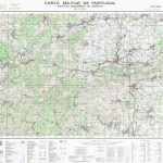
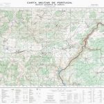
Topographic survey of Portugal at 1:50,000 from the Instituto Geogrรกfico do Exรฉrcito, the country’s military survey organisation. The maps have contours at 20m intervals and in addition to the standard features shown on topographic mapping at this scale also indicate various types of terrain or vegetation (sand, terraces, rocks, woodlands, vineyards, etc). Each sheet covers an area of 32 x 20km (20 x 12.5 miles approx). The maps have a 1-km UTM grid plus latitude and longitude coordinates for the map corners. Map legend and a glossary of terms used on the maps include English.EDITION DATES: most titles in this series date from 1990s or later.To see all the titles in this series please click on the series link.

Related Products:
 Mora
Pombal
Espinhosela
Mora
Pombal
Espinhosela
 Aveiro
Vagos
Valenca
Moncao
Elvas
Bombarral
Redondo
Alcobaca
Gouveia
Braga
Braganca
Sabugal
Barrancos
Portel
Mirandela
Almeida
Penamacor
Aveiro
Vagos
Valenca
Moncao
Elvas
Bombarral
Redondo
Alcobaca
Gouveia
Braga
Braganca
Sabugal
Barrancos
Portel
Mirandela
Almeida
Penamacor
 Fundao
 Carvicais
Nisa
Carvicais
Nisa
 Evora
Santarem
Mourao
Agueda
Deilao
Evora
Santarem
Mourao
Agueda
Deilao
 Anadia
Quadrazais
Oleiros
Alcains
Serta
Retorta
Torrao
Monsaraz
Almodovar
Chouto
Rio Xevora
Rio Chanca
Anadia
Quadrazais
Oleiros
Alcains
Serta
Retorta
Torrao
Monsaraz
Almodovar
Chouto
Rio Xevora
Rio Chanca