Disclosure : This site contains affiliate links to products. We may receive a commission for purchases made through these links.
Bangladesh & India East ITMB
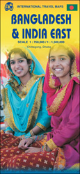
Bangladesh at 1:750,000 on an indexed map from ITM, with street plans of central Dhaka and Chittagong, plus on the reverse a road map of north-eastern India with a street plan of Kolkata plus an enlargement of the city’s environs.On one side is an indexed map of Bangladesh at 1:750,000. Distances are shown on main roads and railway lines are included. The map also shows administrative borders with names of the provinces. Town names are annotated with icons indicating that facilities and/or places of interest can be found there. The map also highlights various other interesting sites. Latitude and longitude lines are drawn at 30’ intervals. The map is accompanied by street plans of central Dhaka and Chittagong, highlighting various facilities and places of interest, plus notes about the country, etc.On the reverse is an indexed road map of North-Eastern India and eastern Nepal at 1:1,500,000, extending in India south-west to Sambalpur and Bhubaneshwar and within Nepal west to Pokhara. Please note that coverage of Bangladesh on that side of the map is incomplete, with the central part of the country blocked by the index. The map shows the regions road and rail connections, local airports, state boundaries, and various places of interest. Topography is indicated by altitude colouring in feet, although peak heights are given in metres. Latitude and longitude lines are drawn at 1ยฐintervals. An enlargement shows the environs of Kolkata (Calcutta) in greater detail, and also included is a street plan of central Kolkata highlighting important buildings, various facilities, etc.


