Disclosure : This site contains affiliate links to products. We may receive a commission for purchases made through these links.
Bangkok Marco Polo City Map
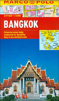
Waterproof and tear-resistant street plan of Bangkok at 1:15,000 from Marco Polo Travel Publishing with a diagram of the metro network, a road map of the city’s environs, and an index which also lists various facilities and places of interest.The plan covers the city with its suburbs, extending west beyond the expressway network and east to include the districts across the Chao Phraya River. Bus routes are shown with line numbers and where appropriate, the direction. Metro stations are clearly marked and on the river ferry services are shown. For drives the map highlights principal traffic routes across the city, clearly shows the interchanges onto expressways and indicates one way streets. Important buildings are highlighted and named. Names of suburbs or districts are shown in Thai alphabet.Street index on the reverse side includes separate lists and where appropriate contact details of various places of interest and facilities, such as public transport information, museums and other attractions, recommended shops and shopping centres etc.Also provided is a plan of Bangkok’s metro network, plus a map of Greater Bangkok showing exit routes from the city.Cartography in this title is from the renowned German map publishers MairDumont and the multilingual map legend includes English.

Related Products:
 Istanbul Marco Polo City Map
 St Petersburg Marco Polo City Map
 Warsaw Marco Polo City Map
 Bangkok and Greater Bangkok Nelles
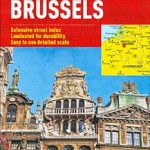 Brussels Marco Polo City Map
 Cape Town Marco Polo City Map
 Rio de Janeiro Marco Polo City Map
 Hong Kong Marco Polo City Map
 Budapest Marco Polo City Map
 Prague Marco Polo City Map
 Florence Marco Polo City Map
 Boston Marco Polo City Map
 Berlin Marco Polo City Map
 Bangkok
 Bangkok & Thailand South ITMB
 Bangkok Borch
 Helsinki City Map
 Bangkok Handy Atlas
 Munich Marco Polo City Map
 Bangkok Marco Polo Pocket Guide 2019 – with pull out map
 Innsbruck City Map
 Riga City Center Jana Seta Street Plan
 Brisbane UBD Gregory`s City Pocket 460
 Bangkok and the Nearby Provinces
 Frankfurt Marco Polo City Map
 Hamburg Marco Polo City Map
 Porto Michelin City Plan and Index
 Amsterdam Michelin City Map
 Bangkok Lonely Planet City Map
 Bangkok Walks Street Plan
 Brazil – Bolivia – Paraguay – Uruguay Marco Polo Map
 Moscow Jana Seta Street Plan
 Old City of Jerusalem Map
 Melbourne Suburbs & City Centre UBD Gregory`s 318
 South Africa – Namibia – Botswana Marco Polo Map
 Kiev F&B City Pocket
 Sydney Suburbs & City Centre UBD Gregory`s 218
 Santiago de Chile de Dios CityMap