Disclosure : This site contains affiliate links to products. We may receive a commission for purchases made through these links.
Banff & Mount Assiniboine Gem Trek
Banff – Mount Assiniboine area at 1:100,000 on a light, waterproof and tear-resistant map from Gem Trek Publishing in their series of detailed hiking maps of the Canadian Rockies. On the reverse are descriptions of several day hikes and overnight trips, plus plenty of other tourist information.The map covers the most popular hiking and mountain biking terrain in the Banff National Park, from Lake Louise in the north to the southern boundary of the park, plus all of Mt. Assiniboine Provincial Park. Contours are at 50m intervals, with subtle relief shading and colouring for forested areas, rocky or alpine terrain and glaciers. The map has a 2km UTM grid and margin ticks at 5’ of latitude/longitude.On the reverse there are enlargements at 1:50 000 of the Mt. Assiniboine area (with contours at 25m) and of the Sunshine Village and Sunshine Meadows. Also included is a street plan of Banff annotated with tourist facilities. Accompanying notes describe eight day hikes from Banff Townside, treks near Lake Minnewanka and Sunshire Meadows, four overnight trips, and a selection of mountain bike trails. Also provided are full details of backcountry accommodation, safety tips and other useful information.

Related Products:
 Banff – Egypt Lake Gem Trek
 Bow Lake & Saskatchewan Crossing Gem Trek Map
 Banff Up-Close Gem Trek
 Banff National Park Gem Trek
 Jasper & Maligne Lake Gem Trek
 Kananaskis Lakes Gem Trek
 Canadian Rockies – Banff – Jasper – Yoho Gem Trek Map
 Banff & Jasper National Parks ITMB
 Canada: Gem Trek Hiking Maps of the Banff & Jasper National Parks & the Canadian Rockies
 Best of Lake Louise Gem Trek
 Kootenay National Park Gem Trek Map
 Waterton Lakes National Park Gem Trek Map
 Canmore and Kananaskis Village Gem Trek
 Moon Banff National Park
 50 Walks and Hikes in Banff National Park
 Calgary – Banff & Enviros FastTrack
 Banff – Yoho & Kootenay NP Recreation Map & Visitor Guide
 Banff North – Banff and Yoho National Parks
 Banff South – Banff & Kootenay National Parks
 Columbia Icefield Gem Trek Map
 Lonely Planet Banff, Jasper and Glacier National Parks
 Highwood & Cataract Creek – Kananaskis Country Gem Trek Map
 Canadian Rockies – Banff – Kootenay – Yoho Parks ITMB
 Lake O`Hara Gem Trek Map
 Moon Best of Glacier, Banff & Jasper (First Edition): Make the Most of One to Three Days in the Parks
 Banff, Macduff & Turriff – Fyvie OS Explorer Map 426 (paper)
 Banff, Macduff & Turriff – Fyvie OS Explorer Active Map 426 (waterproof)
 Royal Trek
 Turkey`s Highest Peaks – Mount Ararat – Kackar Mountains – Mount Suphan terraQuest Trekking Map
 Best of Canmore Gem Trek
 Gosainkunda – Trek to Shiva`s Sacred Lake
 Iceland Hikes – with Reykjavik City Guide: 11 selected trails including 1- to 3-day hikes and the Laugavegur Trek
 Frommer`s Banff day by day
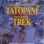 Tatopani Trek
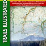 Mount St Helens – Mount Adams – Gifford-Pinchot National Forest WA
 Explorer`s Guide 50 Hikes in Vermont
 The Canadian Rockies Trail Guide
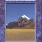 Mount Kailash Trek – Tibet`s Sacred Mountain & Western Tibet
 Canada: NGS Trails Illustrated Maps of Banff and Jasper
 Moon Vancouver & Canadian Rockies Road Trip: Victoria, Banff, Jasper, Calgary, the Okanagan, Whistler & the Sea-To-Sky Highway