Disclosure : This site contains affiliate links to products. We may receive a commission for purchases made through these links.
Bamfurlong and Bryn Gates 1906

Bamfurlong and Bryn Gates in 1906 in a fascinating series of reproductions of old Ordnance Survey plans in the Alan Godfrey Editions, ideal for anyone interested in the history of their neighbourhood or family. The map covers an area south of Wigan, stretching from Bamfurlong southward to Lily Farm and the northern tip of Ashton in Makerfield. Features include Bryn Gates hamlet, the LNWR main line with Bamfurlong station, Bamfurlong Hall, Long Lane Sidings Cross Tetley`s Sidings, Mains Colliery, Lily Lane Colliery, Long Lane Pits, Garswood Hall Collieries, tramway along the Bolton Road, several extensive mineral railways, Bryn Hall, etc. On the reverse is an extract from the Six Inch to the Mile map covering the area eastward to Bryn, Rose Hill, Downall Green and Gustavus Hillock, southward to Stubshaw Cross and Town Green. About the Alan Godfrey Editions of the 25″ OS Series:Selected towns in Great Britain and Ireland are covered by maps showing the extent of urban development in the last decades of the 19th and early 20th century. The plans have been taken from the Ordnance Survey mapping and reprinted at about 15 inches to one mile (1:4,340). On the reverse most maps have historical notes and many also include extracts from contemporary directories. Most maps cover about one mile (1.6kms) north/south, one and a half miles (2.4kms) across; adjoining sheets can be combined to provide wider coverage.FOR MORE INFORMATION AND A COMPLETE LIST OF ALL AVAILABLE TITLES PLEASE CLICK ON THE SERIES LINK.

Related Products:
 Easington Lane and Bryn Gates 1896
 Carlton Main & Shafton Two Gates 1914 – 263.13
Hindley Green 1906
Carlton Main & Shafton Two Gates 1914 – 263.13
Hindley Green 1906
 Leeds East 1906
 Walton on the Hill 1906
 Leeds South and South East 1906
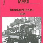 Bradford East 1906
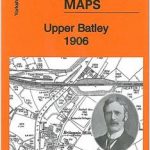 Upper Batley 1906
Earlestown South 1906
Lostock Hall and Farington North 1909
Upper Batley 1906
Earlestown South 1906
Lostock Hall and Farington North 1909
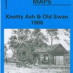 Knotty Ash and Old Swan 1906
 Kirkdale 1906
 Liverpool Toxteth 1906
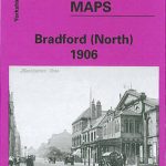 Bradford North 1906
 Rainhill 1906
 Central Liverpool 1906 – 106.14b
Canterbury 1906 – 46.03
Hurst and North Ashton 1906
Central Liverpool 1906 – 106.14b
Canterbury 1906 – 46.03
Hurst and North Ashton 1906
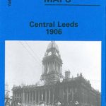 Central Leeds 1906 – 218.02b
Stanley 1895
South Shields 1895
Stanley 1915
Dipton 1916
Sandwell Hall 1902
Gateacre 1904
Central Leeds 1906 – 218.02b
Stanley 1895
South Shields 1895
Stanley 1915
Dipton 1916
Sandwell Hall 1902
Gateacre 1904
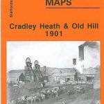 Cradley Heath and Old Hill 1901
New Broughton and Stansty Hall 1909
Cradley South 1901
Wigan West 1908
Cradley Heath and Old Hill 1901
New Broughton and Stansty Hall 1909
Cradley South 1901
Wigan West 1908
 Hazel Grove 1897
Redruth 1906
Bodmin 1906
Hazel Grove 1897
Redruth 1906
Bodmin 1906
 Bradford Central 1906
 Holbeck & New Wortley 1906 – 218.05b
 Meanwood and Far Headingley 1906
 Sheffield Longley 1902
Wakefield West 1905
Rhosllanerchrugog 1909
Sheffield Longley 1902
Wakefield West 1905
Rhosllanerchrugog 1909
 Upper Edmonton 1894 – 3a
Wanstead 1915 – 24.3
Upper Edmonton 1894 – 3a
Wanstead 1915 – 24.3