Disclosure : This site contains affiliate links to products. We may receive a commission for purchases made through these links.
Autour du Thabor: Modane – Bardonecchia – Brianรงon
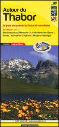
Mont Thabor area at 1:50,000 on a contoured and GPS compatible map from Editions Didier Richard in their series of walking maps of French Alps and other popular hiking regions of south-eastern France. Coverage extends from Modane in the north to Brianรงon in the south-east, and west to Valloire.The base map with cartography from the IGN has contours at 50m intervals enhanced by shading, graphic relief and colouring for woodlands. An overprint prominently highlights the main route of the Tour du Mont Thabor, plus several variants for shorter or longer circuits, including sections of the GR5. Symbols indicate mountain refuges and other accommodation options, religious and military buildings, tourist offices, locations with access by train, etc. The map has a 1-km UTM grid. Map legend includes English. Also provided are photos and details of 12 mountain refuges and other useful addresses.To see other titles in this series please click on the series link.

Related Products:
 Bardonecchia – Monte Thabor – Sauze d`Oulx 25K IGC Map No. 104
 Nevache – Mont Thabor – Cols du Galibier et du Lautaret IGN 3535OT
 Nevache – Mont Thabor – Cols du Galibier et du Lautaret IGN WATERPROOF 3535OTR
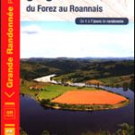 GRP: Autour des Gorges de la Loire du Forez au Roannais FFRP Topo-guide No. 420
 Pica d`Estats – Mont-roig Editorial Alpina
 Alta Valle Susa – Bardonecchia – Oulx Fraternali Editore 01
 Pica d`Estats – Mont-roig – Vall Ferrera – Valls de Cardos Editorial Alpina
 Mont-Blanc – Annecy Didier Richard 02
 Autour du Mont-Ventoux et des Dentelles de Montmirail
 Mont Blanc Pocket Map Edition Didier Richard
 Brianรงon – Vallรจe de la Guisane – Vallรจe de la Clarรจe
 Mont Blanc Massif IGC 4
 French Alps – Via Ferratas – 66 Routes Between Geneva and Brianรงon
 Brianรงonnais ‘“ Queyras IGN 75005
 Les Trois Vallees – Modane – PN de la Vanoise IGN 3534OT
 South Tyrol Kompass Hiking & Recreational Kompass Ring-binder Atlas No. 2703: Bormio – Merano – Bolzano – Cortina d`Ampezzo
 Mont Blanc – Chamnonix – Courmayeur – Grand St-Bernard Swisstopo SKI 292S
 Bigorre – Cauterets – Gavarnie – Saint-Lary-Soulan – Pyrenees NP Rando Editions 4
 Sierra Nevada – La Alpujarra Editorial Alpina
 Les Trois Vallees – Modane – PN de la Vanoise IGN WATERPROOF 3534OTR
 Mercantour & Alpi-Marittime Didier Richard 07
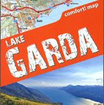 Lake Garda terraQuest Trekking Map
 Alta Garrotxa – Comanegra – Bassegoda – el Mont Editorial Alpina
 Conca di Aosta – Mont Emilius – Mont Fallere L`Escursionista Editore 4
 Congost de Mont-rebei Editorial Alpina
 Tour du Mont Blanc Editions MPA Panoramic Map
 Mont Blanc Rando Editions
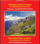 Stara Planina Western: Berkovita to Zlatitsa Domino Map
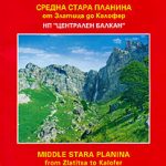 Stara Planina Central: Zlatitsa to Kalofer Domino Map
 Tour du Mont Blanc L`Escursionista Editore Map-Guide
 Bรฉarn – Aspe – Ossau – Pyrenees National Park Rando Editions 3
 Canigou-Garrotxa Rando Editions 10
 La Vรฉloscรฉnie: Paris to Mont-Saint-Michel Cycle Route (434km)
 Bavarian Alps 3-in-1 – Outdoor Maps Ring Binder with full coverage Kompass 2702
 South-Holland South – Goeree-Overflakkee Falkplan Cycling Map 15
 Luchon Rando Editions 5
 Pays Basque East Rando Editions 2
Bachimala – Valles de Chistau y Bielsa Editorial Alpina
Pays Basque East Rando Editions 2
Bachimala – Valles de Chistau y Bielsa Editorial Alpina
 GRP: Tours du Bassin minier FFRP Topo-guide No. 5962