Disclosure : This site contains affiliate links to products. We may receive a commission for purchases made through these links.
Austro-Hungarian Empire 1890 F&B
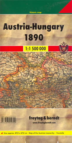
The Austro-Hungarian Empire in 1890 on a reproduction of a map produced by Gustav Freytag for his cartographic company in Vienna. The map, drawn at 1:1,500,000, shows internal administrative provinces within the Dual Monarchy, from Bohemia, Moravia, Silesia and Galicia in the north to Bosnia and Herzegovina in the south, with coverage including the neighbouring areas of the Balkans.The map shows railway lines. Skillfully executed hachures present the relief, with plenty of names of geographical features. Latitude and longitude lines are drawn at 1ยฐ intervals.

Related Products:
 Austro-Hungarian Empire 1890 Freytag & Berndt Wall Map
 Austro-Hungarian Dual Monarchy
 Bosnia & Montenegro ITMB
 Balkans NGS Classic Wall Map PAPER
 South Tyrol – Dolomites Tabacco Road and Panorama Map
 Bosnia-Herzegovina – Montenegro Reise Know-How
 Algeria (Road Edition)
 Farther India
 Slovenia, Croatia and Bosnia-Herzegovina
World Regions c. 1890 MEDIUM
Slovenia, Croatia and Bosnia-Herzegovina
World Regions c. 1890 MEDIUM
 Algeria Road Edition Wall Map
 Dolomites ‘“ Lake Garda ‘“ Verona – Venice 200K Tabacco Road & Panorama Map
Farther India MEDIUM
Dolomites ‘“ Lake Garda ‘“ Verona – Venice 200K Tabacco Road & Panorama Map
Farther India MEDIUM
 Dolomites Tabacco UNESCO Tourist Map
 Europe: Stanfords Map of Europe in 1884 SMALL
 Argentina F&B
 Balkans NGS Classic Wall Map ENCAPSULATED
 Russia Western & Central with the Neighbouring States
 Norway South Reise Know-How
 Alaska NGS Wall Map PAPER
 Croatia F&B
 Brazil Central and South Nelles
 Argentina South & Tierra del Fuego ITMB
 Poland Southeast Reise Know-How
 South Western Bohemia
 Macedonia Gizi Map
 East Tibet Gecko Map
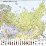 Russia and the Neighbouring Countries Wall Map
 Kenya – Serengeti Nelles
 Albania F&B
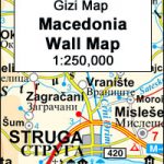 Macedonia Wall Map
Sri Lanka & India South ITMB
Macedonia Wall Map
Sri Lanka & India South ITMB
 Algeria Gizi Geographical Map
 Germany East F&B
 Poland Southwest Reise Know-How
 The Penguin Map of the World
 Europe Travellers` Railway Map
 National Geographic The Balkans Classic 768 x 597 mm
 Algeria Geographical Wall Map