Disclosure : This site contains affiliate links to products. We may receive a commission for purchases made through these links.
Austria: Kรผmmerly+Frey Recreational Maps
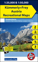
Popular recreational areas of the Austrian Alps on GPS compatible, double-sided maps from Kรผmmerly+Frey printed on sturdy, waterproof and tear-resistant synthetic paper; contoured, with hiking, cycling and ski routes, accommodation facilities, locations for other recreational activities, etc.Scales are either 1:50,000 or 1:35,000. Contour interval is 40m, enhanced by relief shading and finely drawn additional graphic relief to provide an excellent representation of the terrain. The maps have plenty of names of peaks, valleys, etc, plus colouring/graphics indicating different types of vegetation, and show boundaries of national parks or other protected areas.An overprint, graded according to the difficulty of the route, highlights local hiking trails and long-distance paths indicating, where appropriate, their numbers or names. Also marked are local and long-distance cycle routes, plus a selection of mountain-bike trails, cross-country and alpine ski routes and horse-riding paths. Symbols mark locations for other outdoor activities (climbing, paragliding), different types of accommodations including alpine huts, campsites and youth hostels, sites of botanical or cultural interest, etc. The maps have a 1-km UTM grid. Map legend includes English.Each title also includes a small road map of the region around the area covered by it.

Related Products:
 Germany: Kรผmmerly+Frey Hiking and Recreational Maps
 France: Kummerly + Frey Recreational Maps of the Vosges Mountains and Alsace
 Fichtelgebirge 35K Kรผmmerly + Frey Map No. 36
 Lower Rhine – Kleve – Wesel 50K Kรผmmerly + Frey Map No. 61
 Flensburg – Schleswig 50K Kรผmmerly + Frey Map No. 9
 Porta Westfalica – Minden 50K Kรผmmerly + Frey Map No. 58
Swabian Jura: Mรผnsinger Alb 35K Kรผmmerly + Frey Map No. 42
Porta Westfalica – Minden 50K Kรผmmerly + Frey Map No. 58
Swabian Jura: Mรผnsinger Alb 35K Kรผmmerly + Frey Map No. 42
 Hochsauerland – Rothaargebirge 50K Kรผmmerly + Frey Map No. 30
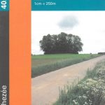
Black Forest: Triberg 35K Kรผmmerly + Frey Map No. 40
Hochsauerland – Rothaargebirge 50K Kรผmmerly + Frey Map No. 30
Black Forest: Triberg 35K Kรผmmerly + Frey Map No. 40
 Lรผbeck – Wismar 50K Kรผmmerly + Frey Map No. 12
 Mรผnsterland Ost – Beckumer Berge 50K Kรผmmerly + Frey Map No. 59
 Fischland – Darร – Kรผhlungsborn 50K Kรผmmerly + Frey Map No. 13
 Black Forest: Freudenstadt 35K Kรผmmerly + Frey Map No. 39
 Swabian Jura: Hohenzollern 35K Kรผmmerly + Frey Map No. 41
Naturpark Mass – Schwalm – Nette 50K Kรผmmerly + Frey Map No. 62
Swabian Jura: Hohenzollern 35K Kรผmmerly + Frey Map No. 41
Naturpark Mass – Schwalm – Nette 50K Kรผmmerly + Frey Map No. 62
 Odenwald – Heidelberg – Bergstrasse 35K Kรผmmerly + Frey Map No. 35
 Spessart North – Bad Orb – Steinau – Burgsinn 35K Kรผmmerly + Frey Map No. 49
 Hohe Mark / Mรผnsterland West 50K Kรผmmerly + Frey Map No. 60
 Pfรคlzerwald (Palatinate Forest) 50K Kรผmmerly + Frey Map No. 24
 Eifel West – Schneifel 35K Kรผmmerly + Frey Map No. 34
 Usedom Island 50K Kรผmmerly + Frey Map No. 15
 Spreewald – NP Dahme-Heideseen 50K Kรผmmerly + Frey Map No. 29
 Kiel – Groรer Plรถner See 50K Kรผmmerly + Frey Map No. 10
 Lower Middle Rhine: Bonn to Koblenz 35K Kรผmmerly + Frey Map No. 31
 Erzegebirge – Klingenthal – Altenberg – Fichtelberg – Oberwiesenthal – Seiffen 50K Kรผmmerly + Frey Map No. 48
 Fehmarn Island – The Baltic Coast of Schleswig-Holstein 50K Kรผmmerly + Frey Map No. 11
 Switzerland: Kรผmmerly + Frey 60K Walking Maps
 Italy: Kรผmmerly + Frey Outdoor Maps of Northern Italy
 Switzerland: Kรผmmerly + Frey 120K Holiday Maps
 France: IGN 75K/25K TOP75 Recreational Maps
 Switzerland: Kรผmmerly + Frey 60K Cycling Maps
 Austria/Germany/Italy: Alpenverein Hiking & Ski Maps
 Austria: Freytag & Berndt Hiking Maps
 Austria/Germany/Slovenia: Kompass Hiking Maps
 Italy: Kรผmmerly + Frey 200K Regional Road Maps
 Bad Gastein K+F Outdoor Map 16
 Germany: Rhineland-Palatinate 50K Topographic Survey Recreational Maps
 Vienna Woods / Wienerwald K+F Outdoor Map 20
 Wรถrthersee – Ossiacher See K+F Outdoor Map 17
 Wiener Hausberge K+F Outdoor Map 21