Disclosure : This site contains affiliate links to products. We may receive a commission for purchases made through these links.
Austria/Germany/Slovenia: Kompass Hiking Maps

Kompass recreational maps providing extensive coverage of Austria and Germany plus the Slovenian Alps, with hiking and cycling routes on a topographic base, various types of accommodation, recreational facilities, places of interest, etc. Many titles are now printed on waterproof and tear-resistant plastic and/or published as competitively priced sets of two or more maps.CARTOGRAPHY: the maps are contoured with additional shading, graphic relief and colouring to provide a more detailed picture of the terrain, vegetation and/or land use. Contour interval varies from 10m in the coastal areas of Northern Germany to 40 or 50 metres in the mountainous regions. All the maps highlight local and long-distance waymarked footpaths, including climbing trails. Most titles also show cycling routes, mountain bike trails, and, the in mountainous areas, ski routes. The maps indicate various types of accommodation (selected inns and hotels, youth hostels, campsites, mountain refuges), as well as recreational facilities, places of interest, etc. Latest editions also show access by public transport with bus stops and/or Park+Ride facilities.GEOGRAPHICAL COORDINATES: unless indicated to the contrary in the individual description, the maps have a UTM grid for GPS users. MAP LEGEND: most maps now include full English legend, particularly titles covering the Alpine areas. Some maps covering mainly eastern Austria or the less popular parts of Germany may still have a legend in German only.OTHER FEATURES: selected titles include on the reverse a panorama drawing of their area with names of villages, peaks, valleys, etc. and/or have a booklet with pictures of local wild flowers with their Latin names, as indicated in the individual description.BOOKLETS: PLEASE NOTE BEFORE ORDERING! – many titles come with a booklet describing the area and/or various hiking routes. Unless indicated in the individual description that the booklet includes English, these booklets are in GERMAN only. The booklets are not necessary to use the maps since, as stated above, full English language map legend is provided.Kompass are Europeโ€s largest publishers of walking maps, with extensive coverage of hiking areas in other countries, all listed on our website.

Related Products:
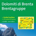 Italy: Kompass 25K/40K Hiking Maps of the Dolomites
 Italy: Kompass 50K Hiking Maps
 NP Kellerwald-Edersee – Habichtswald NP – Medebach Hiking Region Kompass 845
 Germany: Freytag & Berndt Hiking and Leisure Maps
 The Ruhr 2-Map Set Kompass 823
 Weinviertel 2-Map Set Kompass 204
 Neusiedler See Kompass 215
 Innviertel – Hausruck 2-Map Set Kompass 201
 Saarland 2-Map Set Kompass 825
Starnberger See Kompass 793
Saarland 2-Map Set Kompass 825
Starnberger See Kompass 793
 Rรผgen Kompass 737
 Frankenhรถhe Kompass 164
 Mรผritz NP Kompass 853
 Nuremberg – Erlangen Kompass 170
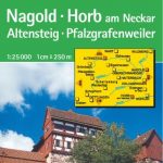 Nagold – Horb Kompass 874
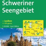 Schweriner Seengebiet Kompass 850
 Gesause – Ennstal Alps – Pyhrnpass – Eisenerz Kompass 69
 Imst – Telfs – Kรผhtai – Mieminger Kette Kompass 35
Tannheimer Tal Kompass 04
Imst – Telfs – Kรผhtai – Mieminger Kette Kompass 35
Tannheimer Tal Kompass 04
 Mรผritz and Environs 2-Map Set Kompass 855
 Hohe Tauern NP 3-Map Set Kompass 50
Berlin and Environs 4-Map Set Kompass 700
Hohe Tauern NP 3-Map Set Kompass 50
Berlin and Environs 4-Map Set Kompass 700
 Millstรคtter See Kompass 066
 Altรถtting – Burghausen Kompass 199
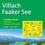 Villach – Faaker See Kompass 062
The Ruhr 3-Map Set Kompass 821
Villach – Faaker See Kompass 062
The Ruhr 3-Map Set Kompass 821
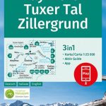 Mayrhofen – Tuxer Tal – Zillergrund Kompass 037
Hamburg and Environs 2-Map Set Kompass 725
Mayrhofen – Tuxer Tal – Zillergrund Kompass 037
Hamburg and Environs 2-Map Set Kompass 725
 Seefeld in Tirol – Leutasch Kompass 026
 Kiel – Westensee NP – Mittelholstein Kompass 709
 Lavanttal – Saualpe – Koralpe Kompass 219
 Zell am See – Kaprun Kompass 030
Innsbruck – Brenner Kompass 36
Zell am See – Kaprun Kompass 030
Innsbruck – Brenner Kompass 36
 Burgenland 2-Map Set Kompass 227
Vorarlberg 2-Map Set Kompass 292
Burgenland 2-Map Set Kompass 227
Vorarlberg 2-Map Set Kompass 292
 Harz 2-Map Set Kompass 450
Deister – Sรผntel and Saupark Kompass 864
Lechtal Alps – Hornbachkette Kompass 24
Harz 2-Map Set Kompass 450
Deister – Sรผntel and Saupark Kompass 864
Lechtal Alps – Hornbachkette Kompass 24
 Stralsund – Greifswald – Grimmen Kompass 858
Hochschwab – Mariazell – Eisenwurzen Kompass 212
Stralsund – Greifswald – Grimmen Kompass 858
Hochschwab – Mariazell – Eisenwurzen Kompass 212