Disclosure : This site contains affiliate links to products. We may receive a commission for purchases made through these links.
Austria: 200K Topographic Survey Province Maps

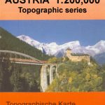
Austriaโ€s provinces in a series of topographic maps at 1:200,000 from Bundesamt fรผr Eich- und Vermessungswesen, the countryโ€s national survey organization, with cartography derived from generalising the 1:50,000 mapping. Topography is shown by contours at 100m intervals, spot heights, hill-shading and graphic relief. Colours and graphics distinguish landscape types e.g. forests, vineyards, swamps. Attractive, finely-drawn detail includes minor roads, tracks, railways, chairlifts and other mountain transport, national parks, and administrative boundaries. Small symbols show many landmarks e.g. towers, castles, refuges, isolated buildings. *Please note:* some of the place names are in very small print.The maps have a UTM grid, with latitude lines at intervals of 12` and longitude at 20`. *Map legend includes English.* Each title also includes a small map with administrative sub-divisions of the province.

Related Products:
 Lower Austria
Burgenland
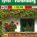
Vorarlberg
Lower Austria
Burgenland
Vorarlberg
 Reunion: IGN 25K Topographic Survey Maps
 Austria: Freytag & Berndt 200K Road Maps
 Switzerland: Swiss Survey 200K Topographic Maps
 Germany: Baden-Wรผrttemberg 50K Topographic Survey Leisure Maps
 Israel: 100K Topographic Survey Maps
 Switzerland: Swiss Survey 50K/33K Hiking Editions of Topographic Maps
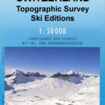 Switzerland: Swiss Survey 50K Topographic Ski Maps
 Netherlands: ANWB 25K Topographic Survey Hiking Maps
 Germany: BKG 200K Topographic Maps
 Iceland: 250K Topographic Survey Road Maps
 Spain: 50K Canary Islands Civilian Topographic Survey
 Georgia: Geoland 200K Regional Travel Maps
 Austria: Freytag & Berndt 150K “Top 10 Tips” Road Maps
 Spain: 100K Catalan Topographic Survey
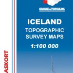 Iceland: Mรกl og menning`s 100K Topographic Survey Maps
 Italy: Touring Club Italiano 200K Regional Road Maps
 Spain: CNIG 200K Provincial Road Maps
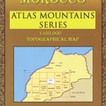 Morocco: Atlas Mountains Topographic Maps
 Albacete Province 200K CNIG Map No. 2
 Zamora Province 200K CNIG Map No. 47
 Valladolid Province 200K CNIG Map No. 46
 Burgos Province 200K CNIG Map No. 10
 Navarra Province 200K CNIG Map No. 33
 Jaรฉn Province 200K CNIG Map No. 23
 Cadรญz Province 200K CNIG Map No. 12
 Leรณn Province 200K CNIG Map No. 27
 Guadalajara Province 200K CNIG Map No. 20
 Zaragoza Province 200K CNIG Map No. 48
 Palencia Province 200K CNIG Map No. 35
 Barcelona Province 200K CNIG Map No. 9
 Mรกlaga Province 200K CNIG Map No. 31
 Cรกceres Province 200K CNIG Map Np. 11
 Cรณrdoba Province 200K CNIG Map No. 16
 A Coruรฑa Province 200K CNIG Map No. 24
 Ourense Province 200K CNIG Map No. 34
 Madrid Province 200K CNIG Map No. 30