Disclosure : This site contains affiliate links to products. We may receive a commission for purchases made through these links.
Aurlandsfjellet Nordeca Tourist Route 20005

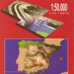
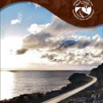
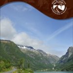
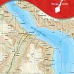
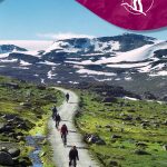
This Aurlandsfjellet National Tourist Route Map belongs to a series of 18 map and postcards sets describing popular tourist routes all over Norway. The map set includes a map in 1: 50,000 presenting an accurate topography (based on the Norwegian topographic survey) which describes local footpaths, cycle or ski routes, sport and recreational facilities, places of interest, places to stay and eat, viewpoints.Aurlandsfjellet National Tourist Route is a 47-kilometre-long stretch of road between Aurlandsvangen by the Aurlandsfjord and Lรฆrdal by the Sognefjord in the county of Sogn og Fjordane in Fjord Norway.The route between Aurland and Lรฆrdal has its highest point at 1,306 metres above seal level. There is snow along the roads most of the summer. Because of this, the road is also called the “Snow road”.Travelling from Lรฆrdal, the view that opens up on the descent towards the dramatic fjord landscape in and around Aurland is astounding, with the award-winning Stegastein viewpoint as the piรจce de rรฉsistance. Made of laminated timber and steel, this platform sticking 30 metres out into thin air, 650 metres above the fjord gives the landscape a whole new dimension.The old buildings at Lรฆrdalsรธyri, the Flรฅm Railway, the Aurlandsdalen Valley and the Nรฆrรธyfjord, which like Geirangerfjord is on UNESCO`s World Heritage List, are all attractions in the area that are well worth a visit. So is the Norwegian Wild Salmon Centre in Lรฆrdal.The set features:One map: scale 1:50,000 Text in three languages (Norwegian, English and German)5 Postcards (13.5x25cm)To see the list of other titles in this series, please click on the series link.

Related Products:
 Sognefjellet Nordeca Tourist Route 20008
 Old Strynefjellsvegen Nordeca Tourist Route 20009
 Havoysund Nordeca Tourist Route 20017
 Ryfylke Nordeca Tourist Route 20002
 Valdresflye Nordeca Tourist Route 20006
 Varanger Nordeca Tourist Route 20018
 Atlantic Road Nordeca Tourist Route 20012
 Gaularfjellet Nordeca Tourist Route 20007
 Helgeland Coast North Nordeca Tourist Route 20013
 Lofoten Nordeca Tourist Route 20014
 Denmark Tourist Map – Major Cities with the Marguerite Route
Garden Route & Route 62 Map Studio
Denmark Tourist Map – Major Cities with the Marguerite Route
Garden Route & Route 62 Map Studio
 Aurland Nordeca 10047
 International Dollard Route – German Fehn Route Bikeline Map-Guide
 Stromberg-Murrtal Cycle Route – Idyllic Route
Danube-Lake Constance Cycle Route – Upper Swabia-Allgรคu Cycle Route Bikeline Map-Guide
Ypres Salient: Tourist Car Route 1914-1918
Stromberg-Murrtal Cycle Route – Idyllic Route
Danube-Lake Constance Cycle Route – Upper Swabia-Allgรคu Cycle Route Bikeline Map-Guide
Ypres Salient: Tourist Car Route 1914-1918
 Munich-Venice Long Distance Cycle Route – incl Dolomites Route Bikeline Map-Guide
 Iller Cycle Route – Zusam Cycle Route Bikeline Map-Guide
 Folgefonna National Park Nordeca 2663
 Norway: Nordeca Regional Touring Maps
 Inner Oslofjord Nordeca Watersport 5200
 Canning Stock Route Design Interaction Guide
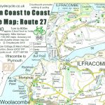 Devon Coast to Coast – Route 27 Cycle Map 66
 Berlin Wall Cycle Route Bikeline Map-Guide ENGLISH
 Catalonia Tourist Road – Regional Divisions Map
 Vltava Cycle Route: ล umava National Park to Prague (480km) Bikeline Map/Guide
 Lรดn Las Cymru Cycle Route North: Holyhead – Llanidloes
 Bergen – 7-Mountains Hike Nordeca 2429
Glan-Blies Route – Barbarossa Route – incl Lauertal Route Bikeline Map-Guide Compact
Bergen – 7-Mountains Hike Nordeca 2429
Glan-Blies Route – Barbarossa Route – incl Lauertal Route Bikeline Map-Guide Compact
 Bath to Bournemouth Sustrans Cycle Route Map
 The Coastal Route Nordeca Sightseeing Map 6009
 The North West Trail Cycle Route
 El Ports: Southern Stars Long-distance Hiking Route
 Tatra Tourist Attractions (Dookola Tatr)
 Rallar Road – Haugastรธl – Finse – Myrdal – Flรฅm Nordeca 2744
 Spain North – Santiago Route Reise Know-How
 Sveio Nordeca 2813
 Norway: Nordeca 500K Regional Road Maps
 Romantic Road Cycle Route