Disclosure : This site contains affiliate links to products. We may receive a commission for purchases made through these links.
Asia: Stanfords Map of Asia in 1884 SMALL
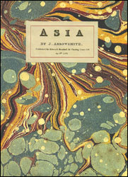
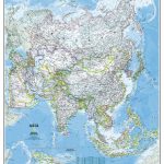
Asia in 1884 on a cloth-backed reproduction (small size) of a map drawn by J. Arrowsmith and published by Edward Stanford. Country boundaries are outlined in bright colours while the pale background with subtle hachure to show the mountain ranges makes the numerous place names easy to read. Many smaller tributaries of the continent’s great rivers are named, from the Ob, the Yenisei and the Lena in the north to the Ganges or the Irrawaddy in the south and the Yangtze in the east. Coverage extends to the Equator, so the southern part of Indonesia is not included.While the north of the continent looks as it was 100 years later except for the changes in the European part of Russia, Central Asia and the Middle East are much different from now, Mongolia is still part of China, etc. Names of Chinese ports open to foreign commerce after the Second Opium War are underlined; ‘Hong-kong I. & Victoria” are duly annotated with Cy for colony. Latitude and longitude lines are drawn at 5ยฐ intervals. Each individual cloth-backed map is sold folded in a colourful case covered with a unique design marbled paper ‘“ no two cases are identical.PLEASE NOTE: this title is also available as a wall map in two different sizes in the ‘Stanfords Classics Collection of Historical Maps”. To see the list of all the titles in this series from the Old Folding Maps please click on the series link.

Related Products:
 Stanford`s Folio Asia Map, by J. Arrowsmith (1884) – A4 Wall Map, Canvas
Stanford`s Folio Asia Map, by J. Arrowsmith (1884) – A3 Wall Map, Canvas
Stanford`s Folio Asia Map, by J. Arrowsmith (1884) – A2 Wall Map, Canvas
Stanford`s Folio Asia Map, by J. Arrowsmith (1884) – A1 Wall Map, Canvas
Stanford`s Folio Asia Map, by J. Arrowsmith (1884) – A3 Wall Map, Paper
Stanford`s Folio Asia Map, by J. Arrowsmith (1884) – A2 Wall Map, Paper
Stanford`s Folio Asia Map, by J. Arrowsmith (1884) – A1 Wall Map, Paper
Stanford`s Folio Asia Map, by J. Arrowsmith (1884) – A4 Wall Map, Canvas
Stanford`s Folio Asia Map, by J. Arrowsmith (1884) – A3 Wall Map, Canvas
Stanford`s Folio Asia Map, by J. Arrowsmith (1884) – A2 Wall Map, Canvas
Stanford`s Folio Asia Map, by J. Arrowsmith (1884) – A1 Wall Map, Canvas
Stanford`s Folio Asia Map, by J. Arrowsmith (1884) – A3 Wall Map, Paper
Stanford`s Folio Asia Map, by J. Arrowsmith (1884) – A2 Wall Map, Paper
Stanford`s Folio Asia Map, by J. Arrowsmith (1884) – A1 Wall Map, Paper
 World: Stanfords Pacific Centred Map of the World 1884 SMALL
 Europe: Stanfords Map of Europe in 1884 SMALL
 Stanfords Folio Asia Map (1884) 60×80 Canvas Print
 A Naturalist`s Guide to the Primates of South East Asia, East Asia and the Indian Sub-Continent
 Asia NGS Executive Wall Map PAPER
 Asia NGS Classic Wall Map PAPER
 Asia NGS Classic Wall Map Laminated
 Eastern Hemisphere: Stanfords Map from 1877 SMALL
 Asia c.1900
 Europe – Middle East – Central Asia Freytag & Berndt Wall Map
 Western Hemisphere: Stanfords Map from 1877 SMALL
 Europe: Stanfords Tourist/Railways Map of Europe 1928 SMALL
 Europe – Middle East – Central Asia F&B
 Asia NGS Executive Wall Map ENCAPSULATED
 Farther India
 MEDIUM
Farther India
Farther India MEDIUM
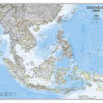 Southeast Asia NGS Classic Wall Map PAPER
 Central Asia Nelles
 Stanford`s Pacific-centred World Map (1884) – A4 Wall Map, Canvas
Stanford`s Pacific-centred World Map (1884) – A3 Wall Map, Paper
Stanford`s Pacific-centred World Map (1884) – A3 Wall Map, Canvas
Stanford`s Pacific-centred World Map (1884) – A2 Wall Map, Paper
Stanford`s Pacific-centred World Map (1884) – A2 Wall Map, Canvas
Stanford`s Pacific-centred World Map (1884) – A1 Wall Map, Paper
Stanford`s Pacific-centred World Map (1884) – A4 Wall Map, Canvas
Stanford`s Pacific-centred World Map (1884) – A3 Wall Map, Paper
Stanford`s Pacific-centred World Map (1884) – A3 Wall Map, Canvas
Stanford`s Pacific-centred World Map (1884) – A2 Wall Map, Paper
Stanford`s Pacific-centred World Map (1884) – A2 Wall Map, Canvas
Stanford`s Pacific-centred World Map (1884) – A1 Wall Map, Paper
 England and Wales: Brookes` Travelling Companion Map MEDIUM
 Spain and Portugal 1842 SMALL
Spain and Portugal 1885 SMALL
Spain and Portugal 1842 SMALL
Spain and Portugal 1885 SMALL
 South East Asia Global Mapping Political Wall Map PAPER
 When in Asia – Customs, Culture and Comedy: Travellers Notes on China, Japan, India, Southeast Asia, and More (from the Best- Selling Cultureshock! Series)
 Devon 1884 Letts County Map
 Southeast Asia NGS Wall Map ENCAPSULATED
Stanford`s Pacific-centred World Map (1884) – A1 Wall Map, Canvas – Print on Demand
Southeast Asia NGS Wall Map ENCAPSULATED
Stanford`s Pacific-centred World Map (1884) – A1 Wall Map, Canvas – Print on Demand
 South East Asia ITMB