Disclosure : This site contains affiliate links to products. We may receive a commission for purchases made through these links.
Asia NGS Executive Wall Map PAPER
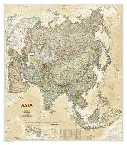
Asia wall map from the National Geographical Society, 84 x 97cm (2ft 9″ x 3ft 2″ approx) ‘“ paper version, in their executive style designed to present current information in colouring reminiscent of antique maps. The map presents Asia at 1: 14,244,000. Coverage includes the whole of the European part of Russia, extending up to the North Pole. In the south-east the island of New Guinea and the Bismarck Archipelago are shown as an inset. The base map has relief shading to show the continent’s topography, with additional graphics indicating deserts, swamps, glaciers, etc. The map shows the names of the numerous geographic features such as mountain ranges, deserts, peaks etc. Heights are given in feet. Countries are shown in subdued colours against the background of oceans in shades of brown and beige. All place names are in English, except for some cities such as Bukhara, where the original name is shown first (Buxoro) with the English equivalent in brackets. The map also shows the networks of main road and railway connections, airports, and oil fields with pipelines. Latitude and longitude lines are drawn at 10ยฐ degrees intervals. Also provided is a glossary of geographical terms and abbreviations used on the map.* This map is also available encapsulated.

Related Products:
 Asia NGS Executive Wall Map ENCAPSULATED
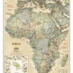
 Africa NGS Executive Wall Map PAPER
 Australia NGS Executive Wall Map PAPER
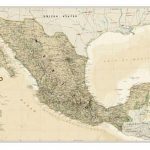
 Mexico NGS Executive Wall Map PAPER
 Asia NGS Classic Wall Map PAPER
 World Maps International Executive Political Wall Map
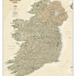 Ireland NGS Executive Wall Map PAPER
 Africa NGS Executive Wall Map ENCAPSULATED
 Scotland NGS Executive Wall Map PAPER
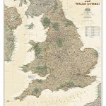 England and Wales NGS Executive Wall Map PAPER
 Australia NGS Executive Wall Map ENCAPSULATED
 Asia NGS Classic Wall Map Laminated
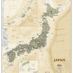 Japan NGS Executive Wall Map PAPER
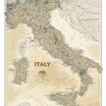 Italy NGS Executive Wall Map PAPER
 Asia Maps International Political Wall Map PAPER
 World NGS Explorer Executive Wall Map PAPER
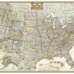
 United States NGS Executive Wall Map PAPER
 France, Belgium and Netherlands NGS Executive Wall Map PAPER
 Britain and Ireland NGS Executive Wall Map PAPER
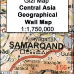 Central Asia Geographical Edition Wall Map
 World NGS Executive Wall Map PAPER
 World NGS Executive Wall Map LARGE PAPER
 World NGS Executive Pacific-Centered Wall Map PAPER
 North America NGS Executive Wall Map PAPER
 Central Asia Road Edition Wall Map
 World NGS Executive Pacific-Centered Wall Map LARGE PAPER
 World NGS Executive Mural Wall Map 3-SHEET SET PAPER
 United States NGS Executive Wall Map LARGE PAPER
 Mexico NGS Executive Wall Map ENCAPSULATED
 Germany NGS Executive Wall Map PAPER
 China NGS Executive Wall Map ENCAPSULATED
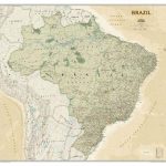 Brazil NGS Executive Wall Map PAPER
 Ireland NGS Executive Wall Map ENCAPSULATED
 Canada NGS Executive Wall Map PAPER
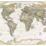
 World Global Mapping Antique Political Wall Map LARGE PAPER
 World NGS Explorer Executive Wall Map ENCAPSULATED
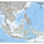 Southeast Asia NGS Classic Wall Map PAPER
 England and Wales NGS Executive Wall Map ENCAPSULATED
Asia Maps International Political Wall Map HANGING STRIPS
Scotland NGS Executive Wall Map ENCAPSULATED
England and Wales NGS Executive Wall Map ENCAPSULATED
Asia Maps International Political Wall Map HANGING STRIPS
Scotland NGS Executive Wall Map ENCAPSULATED