Disclosure : This site contains affiliate links to products. We may receive a commission for purchases made through these links.
Arusha National Park and Mt Meru

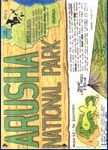
Arusha National Park and Mt Meru in an excellent series of detailed maps from Harms Verlag, a German publisher specializing in coverage of the country. All titles are contoured, indicate various types of terrain and/or vegetation, and carry plenty of tourist information. The maps provide a good supplement for their very attractive map of the whole of Tanzania.*In this title:* a contoured map of the Arusha National Park, plus a street plan of Arusha itself at 1:20,000. On the main map, contours at 50m intervals, hill-shading and altitude tinting vividly portray the relief. Steep slopes of crater rims are marked and swamp and forested areas are distinguished. Road detail includes tracks and the hiking trail to the Meru peak. The park boundary is clearly marked and symbols show various features: entry gates, park HQ, rangers’ posts, huts and lodges, campsites, picnic sites, viewpoints and sites of particular interest. A UTM grid is drawn over the map, and latitude and longitude margin ticks are at 5’ intervals. The street plan of Arusha shows petrol stations, banks, hotels, bus terminals, the post office, information centres, churches, etc. The map legend is in English, German, French and Swahili.


