Disclosure : This site contains affiliate links to products. We may receive a commission for purchases made through these links.
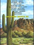
Arizona
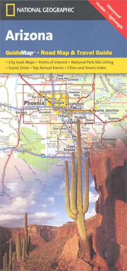
Arizona in a series of US state maps from the National Geographic with cartography from Mapquest, including city maps of the Phoenix conurbation, downtown Phoenix, Tucson, Flagstaff, Yuma and Bullhead City – Laughlin, enlargements of the Grand Canyon, Saguaro and Petrified Forest National Parks, plus a scenic Oak Creek Canyon drive route. The map is printed on lightweight, waterproof and tear-resistant plastic paper.Maps in the NGS State Series clearly show each state’s national parks, forests and other protected areas, with topography indicated by subtle relief shading and plenty of names of mountain ranges, valleys, deserts, etc. Indian Reservations are also marked and various places of interest are highlighted, including historical or natural sites, visitor information centres, campsites, etc.Road network indicates toll roads, rest areas and services, and shows driving distances on main routes. Scenic roads are highlighted. The maps have no geographical coordinates. The index lists both counties, shown on the maps with their administrative boundaries, and towns or cities. Each title includes several enlargements showing in greater detail local towns, national parks and other popular destination, all annotated with places of interest. Also provided are general notes about the state with descriptions of its main sights, a recommendation for a scenic drive, a table of services available in the local sites (both national parks and historical monuments), a calendar of local special events, a distance table and a climate chart.

Related Products:
 USA: NGS State Maps
 California Northern
 Tennessee NGS Guide Map
 Maine
Maine
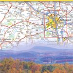 Virginia
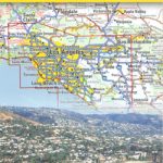 California Southern
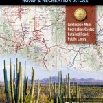
 Arizona Recreational Atlas & Gazetteer
 Arizona Easy-to-Read Rand McNally
 Arizona Benchmark Road & Recreation Atlas
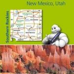 Southern Rockies – Arizona – Colorado – New Mexico – Utah Michelin Zoom 175
 Arizona Recreational Map
 Grand Canyon & Arizona ITMB
 Arizona Easy to Fold Rand McNally
 USA: Antenna Audio American Highway Road Atlas – A3, PAPERBACK
 Aguascalientes State – Aguascalientes City
 Guanajuato State – Guanajuato City
Durango State – Durango City
Guanajuato State – Guanajuato City
Durango State – Durango City
 Tlaxcala State – Tlaxcala City
Zacatecas State – Zacatecas City
Colima State – Colima City
Tlaxcala State – Tlaxcala City
Zacatecas State – Zacatecas City
Colima State – Colima City
 Campeche State – Campeche City
 Oaxaca State – Oaxaca City
 Veracruz State – Xalpa and Veracruz City
 Querรฉtaro State – Querรฉtaro City
 San Luis Potosรญ State – San Luis Potosรญ City
 Mรฉxico State – Toluca
 Michoacรกn State – Morelia
 Jalisco State – Guadalajara
Coahuila State – Saltillo
Jalisco State – Guadalajara
Coahuila State – Saltillo
 Hidalgo State – Pachuca
Nayarit State – Tepic
Sonora State – Hermosillo
Hidalgo State – Pachuca
Nayarit State – Tepic
Sonora State – Hermosillo
 Morelos State – Cuernavaca
 Tabasco State – Villahermosa
 Yucatan State – Mรฉrida
Chihuahua State – Chihuahua City
Yucatan State – Mรฉrida
Chihuahua State – Chihuahua City
 Nuevo Lรฉon State – Monterrey
 Sinaloa State – Culiacรกn – Mazatlan – Los Moches
 Utah Easy-to-Read Rand McNally
Tamaulipas State – Ciudad Vittoria
Utah Easy-to-Read Rand McNally
Tamaulipas State – Ciudad Vittoria