Disclosure : This site contains affiliate links to products. We may receive a commission for purchases made through these links.
Categories
-
Best Sellers
-

NOAA Chart 18704 – San Luis Obispo Bay’”Port San Luis
NOAA maintains the nautical charts and publications for U.S. coasts and the Great Lakes. Over a thousand charts cover 95,000 miles of shoreline and 3.4 million Read More » -
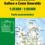
La Maddalena Archipelago – Gallura and Costa Smeralda TCI Map & Guide
-

Fumay IGN 3008SB
Topographic survey of France at 1:25,000 in IGN`s excellent TOP25 / Sรฉrie Bleue series. All the maps are GPS compatible, with a 1km UTM grid plus Read More » -

Szolnok
Szolnok in a series of street plans of Hungary’s main towns from Cartographia in Budapest. The plans cover the whole town with its outer suburbs and, Read More » -

Bill`s New Frock
Bill Simpson wakes up to find he’s a girl, and worse, his mother makes him wear a frilly pink dress to school. How on earth is Read More » -

Road Dahl: Whizzpopping Joke Book
Roald Dahl`s Whizzpopping Joke Book is a collection of hundreds of great jokes would make even the Trunchbull laugh! Inspired by Roald Dahl`s wonderful world, these Read More » -

The Man Who Ate Everything
Jeffrey Steingarten is to food writing what Bill Bryson is to travel writing. Whether he is hymning the joys of the perfect chip, discussing the taste Read More » -

SEMAR Chart 922.7 – Puerto Aventuras, Quintana Roo
Official Mexican Hydrographic Office charts (SEMAR – Secretarรญa de Marina Armada de Mรฉxico) offer a great range of scales for ports along the Mexico Gulf and Read More » -
Shortcut Guide
-

Other Routes – 1500 Years of African and Asian Travel Writing
Travel writing is a genre monopolised by Westerners. For centuries the preserve of Europeans who reported on the “exotic”, it sought to make sense of other Read More »
-


