Disclosure : This site contains affiliate links to products. We may receive a commission for purchases made through these links.
Apuseni Mountains

Apuseni Mountains, the north-western part of Transylvania, at 1:200,000 on a detailed contoured road map from Dimap, with city centre plans of five local towns, plus extensive tourist notes including sightseeing routes.Contour lines and spot heights indicate the relief, with colouring and graphics for forests, orchards and vineyards. Nature reserves and other protected areas are marked. Several classes of road are shown including country tracks and footpaths, plus a selection of signposted tourist trails. Intermediate driving distances are marked on most local routes. Railways are shown with stations. A wide range of symbols indicate various tourist facilities including different types of accommodation, campsites, folk art centres, historical monuments, etc. Where appropriate, names of towns and villages are given both in their current Romanian versions and in the pre-1920 Hungarian ones. The map has no geographical coordinates. Map legend includes English. On the reverse are black and white street plans of city centres in Oradea, Arad, Deva, Cluj-Napoca and Alba Iulia, all annotated with tourist information. Extensive text, including English, provides information about the region and descriptions of seven sightseeing routes. Also provided are lists of recommended accommodation, nature reserves and waymarked hiking paths.

Related Products:
 Stuttgart
 Polish and Slovak Tatra Mountains
 Finland East Karttakeskus Road Map
Finland North Karttakeskus Road Map
Finland East Karttakeskus Road Map
Finland North Karttakeskus Road Map
 Caliman Mountains Dimap Hiking Map
Heilbronn
Caliman Mountains Dimap Hiking Map
Heilbronn
 Gรถppingen
Pforzheim
Offenburg
Freudenstadt
Lรถrrach
Singer
Crailsheim
Bad Urach
Sigmaringen
Bad Saulgau
Gรถppingen
Pforzheim
Offenburg
Freudenstadt
Lรถrrach
Singer
Crailsheim
Bad Urach
Sigmaringen
Bad Saulgau
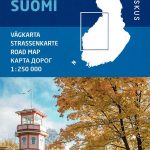 Finland West Karttakeskus Road Map
Bad Mergentheim F515
Finland West Karttakeskus Road Map
Bad Mergentheim F515
 Giurgeu and Hasmas Mountains Dimap Hiking Map
Tรผbingen – Reutlingen
Finland South Karttakeskus Road Map
Giurgeu and Hasmas Mountains Dimap Hiking Map
Tรผbingen – Reutlingen
Finland South Karttakeskus Road Map
 Baden-Baden
Titisee-Neustadt
Villingen-Schwenningen
Waldshut-Tiengen
Biberach an der Riss
Wangen im Allgรคu
Unteres Taubertal – Tauberbischofsheim F512
Karlsruhe – Rhein – Kraichgau F516
Baden-Baden
Titisee-Neustadt
Villingen-Schwenningen
Waldshut-Tiengen
Biberach an der Riss
Wangen im Allgรคu
Unteres Taubertal – Tauberbischofsheim F512
Karlsruhe – Rhein – Kraichgau F516
 Aalen – Hรคrtsfeld – Ostalb F522
Mosbach – Buchen F514
Mannheim – Heidelberg F513
Aalen – Hรคrtsfeld – Ostalb F522
Mosbach – Buchen F514
Mannheim – Heidelberg F513
 Ulm – Blaubeuren – Donau F525
Freiburg im Breisgau – Kaiserstuhl
Lake Constance West
Lake Constance East
Finland: Karttakeskus 250/400K GT Road Maps
Swabian-Franconian Forest – Schwรคbisch Hall 518
Gilau Mountains Dimap Hiking Map
Ulm – Blaubeuren – Donau F525
Freiburg im Breisgau – Kaiserstuhl
Lake Constance West
Lake Constance East
Finland: Karttakeskus 250/400K GT Road Maps
Swabian-Franconian Forest – Schwรคbisch Hall 518
Gilau Mountains Dimap Hiking Map
 Matra Mountains Atlas