Disclosure : This site contains affiliate links to products. We may receive a commission for purchases made through these links.
Antigua & Dominica ITMB

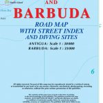
Dominica at 1:50,000 with Antigua at 1:35,000, each shown on one side of a map from ITMB indexed and accompanied by street plans of Roseau plus St John’s and the English Harbour area respectively. Road network is presented on a base showing the islands’ topography by contours and altitude colouring.Symbols indicate various places of interest and facilities, including selected tourist accommodation, beaches, diving and snorkelling sites, marinas, locations of petrol stations, etc. On Dominica the Waiukubuli National Hiking Trail is prominently highlighted. Each side is indexed and has latitude and longitude lines at 5’.Street plans cover the town centres of Roseau and St John’s showing locations of selected hotels and other facilities. The Antigua side also includes an enlargement of the English Harbour area including Nelson’s Dockyard, plus panels with maps of Barbuda (1:25,000), Saint Martin/Sint Maarten, St. Barthรฉlemy and St. Kitts and Nevis.

Related Products:
 Dominica & Saint Lucia ITMB
 Antigua and Barbuda
 Dominica
 Caribbean Islands East & South ITMB Travel Atlas
 Guadeloupe & Dominica ITMB
 Guatemala ITMB
 Virgin Islands (US and British) ITMB
 Vietnam ITMB
 Belize & Eastern Guatemala ITMB
 A29 Dominica
 Saudi Arabia & Kuwait ITMB
 Ghana ITMB
 Senegal & Gambia ITMB
 St Lucia & Dominica Footprint Handbook
 Colombia ITMB
 Bhutan & Northeast India ITMB
 Romania & Moldova ITMB
 Sikkim & India Northeast ITMB
 British Columbia South ITMB
 Namibia ITMB
 Bali & Lombok ITMB
Malta & Gozo ITMB
Bali & Lombok ITMB
Malta & Gozo ITMB
 Cameroon & Gabon ITMB
 Mauritius & Reunion ITMB
 A27 Antigua
 Cambodia Periplus Travel Map
 Sumatra ITMB
 Belarus ITMB
 Bahamas ITMB
 Santiago & Chile North ITMB
 Alberta ITMB
 Hawaii & Honolulu ITMB
 Iran & Tehran ITMB
 California ITMB
Sydney & Australia East ITMB
California ITMB
Sydney & Australia East ITMB
 Japan North & Hokkaido ITMB
 Guyana, Suriname & French Guiana ITMB
 Kilimanjaro & Tanzania North ITMB
 Quito & Central Ecuador ITMB
Sri Lanka & India South ITMB
Quito & Central Ecuador ITMB
Sri Lanka & India South ITMB