Disclosure : This site contains affiliate links to products. We may receive a commission for purchases made through these links.
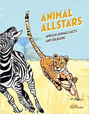
Animal Allstars: African Animals Facts and Folklore

Related Products:
 Gross and Ghastly: Animals: The Big Book of Disgusting Animal Facts
 100 Fun Facts to Sticker: Amazing Animal Facts
 The Big Book of the UK: Facts, folklore and fascinations from around the United Kingdom
 My Animal Book: Facts and Fun Questions and Answers Things to Make and Do
 Animal Squirt BK: Wild Animals
 The Illustrated Compendium of Amazing Animal Facts
Animal Patterns & Colours: Farm Animals
Animal Patterns & Colours: Ocean Animals
Animal Patterns & Colours: Wild Animals
Animal Patterns & Colours: Small Animals
The Illustrated Compendium of Amazing Animal Facts
Animal Patterns & Colours: Farm Animals
Animal Patterns & Colours: Ocean Animals
Animal Patterns & Colours: Wild Animals
Animal Patterns & Colours: Small Animals
 NG Wild Animal Atlas: Earth`s Astonishing Animals and Where They Live
 Baby Animals!: Amazing Adorable Facts
 On Track: Quick ID guide to Southern and East African Animal Tracks
 Amazing Facts About Baby Animals: An Illustrated Compendium
 Animals: A Visual Guide to the Animal Kingdom
 How Animals Live – A guide to the Animal World
 Through the Animal Kingdom: Discover Amazing Animals and Their Remarkable Homes
 Animals Find it! Explore it!: More than 250 things to find, facts and photos! (National Geographic Kids)
 What`s That Animal?: Complete animal faces using colours, doodle & stickers
 LEGO Animal Atlas: with four exclusive animal models
 National Geographic Kids Puzzle Book – Animals: A fact-packed fun book of animal themed puzzles (Puzzle Books)
 100 Fun Facts to Sticker: Dazzling Dinosaur facts
100 Fun Facts to Sticker: Top-Notch Transport Facts
100 Fun Facts to Sticker: Dazzling Dinosaur facts
100 Fun Facts to Sticker: Top-Notch Transport Facts
 African Twilight: The Vanishing Rituals and Ceremonies of the African Continent
 African Violet Caine Prize For African Writing 2012
 Arcadia Britannica: A Modern British Folklore Portrait
 The Magpie and the Wardrobe: A Curiosity of Folklore, Magic and Spells
 A World Full of Animal Stories: 50 Favourite Animal Folk Tales, Myths and Legends
 Animals at Home: Match 27 animals to their homes
 Pasta For Nightingales: A 17th-century handbook of bird-care and folklore
 Treasury of Folklore: Woodlands and Forests: Wild Gods, World Trees and Werewolves
 Japanese Legends and Folklore
ST&G`s Great British Folklore & Superstition Map
Japanese Legends and Folklore
ST&G`s Great British Folklore & Superstition Map
 British Birds: Their Folklore, Names, & Literature
 Japanese Tales from Times Past: Stories of Fantasy and Folklore from the Konjaku Monogatari Shu
 5,000 Awesome Facts: No. 3
 Animal World Globe 15cm: Swivel and Tilt World Animal Globe
 Solar System Fascinating Facts
 Infomania: Awesome Records, Top 10s and Facts
 Every Day Amazing: Fantastic Facts for Every Day of the Year