Disclosure : This site contains affiliate links to products. We may receive a commission for purchases made through these links.
Aneto – Maladeta – PN Posets Editorial Alpina
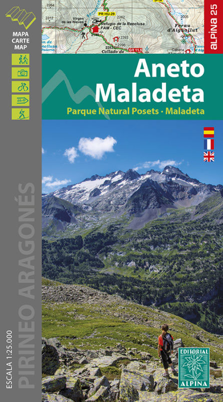
The highest part of the Spanish Pyrenees, the Maladeta massif with Pico de Aneto including the surrounding valleys of Benasque and Barraves, at 1:25,000 on a contoured and GPS compatible map from Editorial Alpina, accompanied by a booklet with English language descriptions of recommended walks and climbs, accommodation details, etc.Vivid presentation of the topography is provided by contours at 10m intervals enhanced by numerous spot heights, relief shading and colouring to indicate vegetation. Local and long-distance waymarked trails and ascents are highlighted. Symbols indicate various types of accommodation (refuges, campsites and camping areas, gรฎtes, summer camps, hotels, etc), restaurants, tourist information centres, sites for skiing, climbing and canyoning, viewpoints, etc. Road network indicates locations of petrol stations and car parks. The map has a 1km UTM grid, plus margin ticks for latitude and longitude at 1’ intervals. Map legend includes English.The accompanying booklet has 29 pages in English with descriptions of 9 hikes and 10 ascents. General information about the area is supplemented by a list of 21 local caves for potholing, advice for other adventure sports, plus contact details for local accommodation options and other useful numbers and web addresses.To see the list of titles in this Editorial Alpina series which provides coverage of most popular hiking areas of Spain please click on the series link.

Related Products:
 Posets-Maladeta Natural Park 2-Map Set Editorial Alpina
 Sierra Nevada – La Alpujarra Editorial Alpina
 Montserrat Nature Park Editorial Alpina
 Montserrat Editorial Alpina
Ordesa and Monte Perdido National Park Editorial Alpina
Montserrat Editorial Alpina
Ordesa and Monte Perdido National Park Editorial Alpina
 Cap de Creus Park Natural Editorial Alpina
 Costabona – Alta Val de Ter Editorial Alpina
 Sierra de Gredos – Almanzor – Laguna Grande Editorial Alpina
 Cotiella ‘“ Peรฑa Montaรฑesa Editorial Alpina
 Cabo de Gata-Nรญjar Natural Park Editorial Alpina
 Sant Maurici Editorial Alpina
 Serra del Cadรญ – Pedraforca Editorial Alpina
Valles de Ansรณ & Echo Editorial Alpina
Ordesa – Monte Perdido National Park Editorial Alpina 2-Map Set
Vall de Boรญ – Aigรผestortes PN Editorial Alpina
Cingles de Berti – Sant Miquel des Fai Editorial Alpina
Sant Llorenc del Munt i l`Obac Editorial Alpina
Serra del Cadรญ – Pedraforca Editorial Alpina
Valles de Ansรณ & Echo Editorial Alpina
Ordesa – Monte Perdido National Park Editorial Alpina 2-Map Set
Vall de Boรญ – Aigรผestortes PN Editorial Alpina
Cingles de Berti – Sant Miquel des Fai Editorial Alpina
Sant Llorenc del Munt i l`Obac Editorial Alpina
 Ordesa and Monte Perdido National Park 2-Map Set Editorial Alpina
 Valle de Canfranc – Valle de Aisa – Candanchu – Astun Editorial Alpina
 Guadarrama – La Pedriza 2-Map Set Editorial Alpina
 Mallorca – Tramuntana Central Editorial Alpina
 Macizo de Monte Perdido – Valle de Ordesa – Pineta Editorial Alpina
 Valles de Belagua y Roncal Editorial Alpina
 Vall Fosca – Montsent de Pallars Editorial Alpina 2-Map Set
Puigsacalm – Bellmunt Editorial Alpina
Spain: Editorial Alpina Walking Maps
Montseny NP – Turo de l`Home – Les Agudas – Matagalls – la Calma Editorial Alpina 2-Map Set
Vall Fosca – Montsent de Pallars Editorial Alpina 2-Map Set
Puigsacalm – Bellmunt Editorial Alpina
Spain: Editorial Alpina Walking Maps
Montseny NP – Turo de l`Home – Les Agudas – Matagalls – la Calma Editorial Alpina 2-Map Set
 Mallorca – Tramuntana South Editorial Alpina
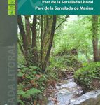 Serralada de Marina Editorial Alpina
 Mallorca – Tramuntana North Editorial Alpina
Val d`Aran by UTMB Editorial Alpina Trail running race Map
Mallorca – Tramuntana North Editorial Alpina
Val d`Aran by UTMB Editorial Alpina Trail running race Map
 Alt Pirineu Natural Park Editorial Alpina
Bachimala – Valles de Chistau y Bielsa Editorial Alpina
Val d`Aran – Mauberme – Montardo – Molieres Editorial Alpina
Alt Pirineu Natural Park Editorial Alpina
Bachimala – Valles de Chistau y Bielsa Editorial Alpina
Val d`Aran – Mauberme – Montardo – Molieres Editorial Alpina
 Congost de Mont-rebei Editorial Alpina
 El Turbรณn ‘“ Alto Valle de Isรกbena Editorial Alpina
Montnegre – Corredor Editorial Alpina
Garraf – la Morella – Eramprunya Editorial Alpina
Serra de Tramuntana Editorial Alpina 4-Map Set
El Turbรณn ‘“ Alto Valle de Isรกbena Editorial Alpina
Montnegre – Corredor Editorial Alpina
Garraf – la Morella – Eramprunya Editorial Alpina
Serra de Tramuntana Editorial Alpina 4-Map Set