Disclosure : This site contains affiliate links to products. We may receive a commission for purchases made through these links.
Andorra Trail Running 40K Ed. Alpina Map
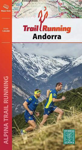
Alternative coverage of Andorra at 1:40,000 from Editorial Alpina on a contoured and GPS compatible map with the highlighting and numbering of trails adjusted to correspond to the descriptions in the accompanying booklet, including a 101km Andorra Grand Trail.The map has contours at 20m intervals, enhanced by relief shading and vegetation colouring, and a 5-km UTM grid. The overprint clearly shows the trails described in the accompanying booklet plus the GR long distance routes (i.e. without highlighting shorter local walks). Symbols indicate different types of accommodation (refuges, campsites, etc), locations for other recreational pursuits (climbing, canyoning, horse riding, etc), and other facilities and places of interest. Road network shows locations of petrol stations. Accompanying booklet provides descriptions of 13 trails, including the 101km Andorra Grand Trail. Map legend and the descriptions on are in Catalan only. PLEASE NOTE: the publisher`s coverage image on the back cover of the booklet is incorrect ‘“ the map covers a slightly smaller area, as shown on our website.To see other titles in this extensive Editorial Alpina series please click on the series link.

Related Products:
 Andorra – Comapedrosa – Engorgs – Jucla – Pessons – Tristaina Editorial Alpina
 Val d`Aran by UTMB Editorial Alpina Trail running race Map
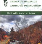 Old Cross-Pyrenean Trail (Camino de Reencuentro): la Seu d`Urgell – Andorra – Auzat
 Cerdanya – Alta Cerdanya – Capcir – Andorra Editorial Alpina
 Mallorca – Tramuntana Central Editorial Alpina
 Mallorca – Tramuntana North Editorial Alpina
 Mallorca – Tramuntana South Editorial Alpina
 Cap de Creus Park Natural Editorial Alpina
 Valle de Tena – Panticosa – Partacua – Sallent Editorial Alpina
 Cabo de Gata-Nรญjar Natural Park Editorial Alpina
Montnegre – Corredor Editorial Alpina
Cabo de Gata-Nรญjar Natural Park Editorial Alpina
Montnegre – Corredor Editorial Alpina
 Vall de Lord – Port del Comte Editorial Alpina
 Alt Pirineu Natural Park Editorial Alpina
Sierra Nevada – La Alpujarra Editorial Alpina
Alt Pirineu Natural Park Editorial Alpina
Sierra Nevada – La Alpujarra Editorial Alpina
 Ibiza – Formentera Editorial Alpina
 Serra de Tramuntana Editorial Alpina 4-Map Set
Ordesa and Monte Perdido National Park Editorial Alpina
Serra de Tramuntana Editorial Alpina 4-Map Set
Ordesa and Monte Perdido National Park Editorial Alpina
 Garrotxa – Zona Volcanica Editorial Alpina
 Serra del Cadรญ – Pedraforca Editorial Alpina
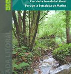 Serralada de Marina Editorial Alpina
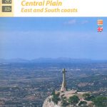 Mallorca Central Plain – East and South Coasts Editorial Alpina
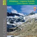 Sierra de Gredos – Almanzor – Laguna Grande Editorial Alpina
 Costabona – Alta Val de Ter Editorial Alpina
 Sobrarbe Central – Ainsa – Boltana Editorial Alpina
 Pica d`Estats – Mont-roig Editorial Alpina
 Caps del Nord – Mallorca Editorial Alpina 2-Map Set
 Valle de Benasque Editorial Alpina
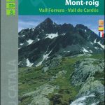
 Pica d`Estats – Mont-roig – Vall Ferrera – Valls de Cardos Editorial Alpina
 Aneto – Maladeta – PN Posets Editorial Alpina
Cotiella ‘“ Peรฑa Montaรฑesa Editorial Alpina
Aneto – Maladeta – PN Posets Editorial Alpina
Cotiella ‘“ Peรฑa Montaรฑesa Editorial Alpina
 Spain: Editorial Alpina Maps of Long-distance Hiking Trails
 La Senda de Camille Editorial Alpina
 Vall Fosca – Montsent de Pallars Editorial Alpina 2-Map Set
 Cami de l`Ossa – Andorra Editorial Piolet
Ordesa – Monte Perdido National Park Editorial Alpina 2-Map Set
Bachimala – Valles de Chistau y Bielsa Editorial Alpina
Sant Maurici Editorial Alpina
Cami de l`Ossa – Andorra Editorial Piolet
Ordesa – Monte Perdido National Park Editorial Alpina 2-Map Set
Bachimala – Valles de Chistau y Bielsa Editorial Alpina
Sant Maurici Editorial Alpina
 Taga – Serra Cavallera Editorial Alpina
Valles de Ansรณ & Echo Editorial Alpina
Taga – Serra Cavallera Editorial Alpina
Valles de Ansรณ & Echo Editorial Alpina