Disclosure : This site contains affiliate links to products. We may receive a commission for purchases made through these links.
Andhra Pradesh

Indian state of Andhra Pradesh on road map from the Delhi-based International Publications, showing many small towns and villages. Please note that, unlike most other titles in this series, this one comes without an accompanying booklet.Additional features around the main map include a physical maps of the state, plus small maps showing annual rainfall, cash crops and industry, plus a distance chart and a facts-and-figures table.Unless indicated to the contrary in the individual description, maps in this series present the state with its constituent districts in different colours and also show the division of districts into talukas. Town symbols indicate both district and taluka headquarters. Road network includes many local roads, some with driving distances, although sometimes locations are marked without road access to them shown on the map. Railway lines are included and local airports are marked. Symbols indicate various locations of interest, including historical sites, wildlife sanctuaries, beaches, etc. In many titles additional panels around the main map and/or in the accompanying booklet provide more information: enlargements with more detailed presentation of the road network, street plans of main cities, etc. To see the list of titles in this series please click on the series link.

Related Products:
 Uttar Pradesh Map-Guide
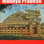 Madhya Pradesh Map-Guide
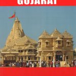 Gujarat Map-Guide
 Tamil Nadu Map-Guide
 Kerala & Lakshadweep Map-Guide
 Rajasthan Map-Guide
 Punjab Map-Guide
 Delhi Map-Guide
 Maharashtra Map-Guide
 Uttarakhand Map-Guide
 Karnataka Map-Guide
 Goa
Goa
 Jharkhand
 Chennai (Madras)
 Middle East F&B
 Bihar
Bihar
 Andorra Trail Running 40K Ed. Alpina Map
 Salzburg State F&B Top 10 Tips
 Sicily F&B Top 10 Tips 2-Map Set
 Sardinia F&B Top 10 Tips 2-Map Set
 Arizona Recreational Map
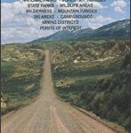
 Montana Western Recreational Map
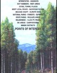
 Montana Eastern Recreational Map
 Gran Canaria F&B
 Brabant Provinces (Flemish and Wallon) and Brussels Region
 Yemen F&B
 Madeira F&B
 Australia UBD Gregory`s Concise Motoring Atlas
 New Mexico Recreational Map
 Nevada Recreational Map
 Idaho Recreational Map
 Utah Recreational Map
 Cabo de Gata-Nรญjar Natural Park Editorial Alpina
 Colorado Recreational Map
 Alaska ITMB
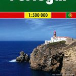 Portugal F&B
 Saxony-Anhalt Marco Polo Regional Map 8
 Bahia de Dios Map-Guide
 Mecklenburg-Vorpommern Marco Polo Regional Map 2