Disclosure : This site contains affiliate links to products. We may receive a commission for purchases made through these links.
American War for Independance – Battles of the Revolutionary Bella Terra War Map
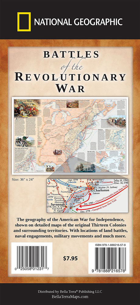
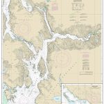
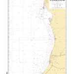
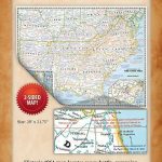
National Geographic’s double-sided map presenting on one side The American War of Independence 1775 – 1783, with on the reverse the War of 1812 fought to resolve many issues outstanding from the earlier conflict. Both maps cover the territory from the Atlantic to the Mississippi, including northern Florida and the border regions of Canada, and indicate present day state names and boundaries. The base map shows main geographical features, as well as names of Indian tribes and of significant Indian settlements.The American War of Independence map shows the area of the 13 American Colonies and the British lands beyond them, indicating directions of military movements and battle sites. Enlargements present in greater detail the New York – New Jersey – Philadelphia region and the Chesapeake Bay, and the surrounding text provides more information on subject such as the Saratoga campaign, the invasion of the Canadian territories, etc. Also provided is a panel showing the North Atlantic and the conflicts between the European states over colonial possessions.The reverse side has a map showing military engagements during the 1812 war, declared by the United States over outstanding issues such as trade restrictions brought about by Britain`s continuing war with France, the impressment of American merchant sailors into the Royal Navy, British support o Indian tribes against American expansion, possible American interest in annexing Canada, etc. Enlargements show the Chesapeake Bay area and military battles along both ends of Lake Eire, with another panel presenting the North Atlantic.This title is also available as a wall map, either in a paper version or encapsulated for greater durability.

Related Products:
 American War of Independence – War of 1812 NGS Folded Map
 American War of Independence – War of 1812 NGS NGS Wall Map PAPER
 American War of Independence – War of 1812 NGS NGS Wall Map ENCAPSULATED
 North American Indian Cultures NGS Wall Map
 Battlefields of the USA Civil War Bella Terra War Map
 USA Rail Museums & Trips – Eastern States Bella Terra Illustrated Map
 Mid-Atlantic Lighthouses Bella Terra Illustrated Map
 USA Rail Museums & Trips – Western States Bella Terra Illustrated Map
 USA Rail Museums & Trips – Central States Bella Terra Illustrated Map
 USA: Bella Terra Maps of Rail Museums & Trips
 USA: Antenna Audio American Highway Road Atlas – A4, PAPERBACK
 USA Lighthouses Bella Terra Illustrated Map & Guide
 Maine Lighthouses Bella Illustrated Terra Map
 Southeast USA Lighthouses Bella Terra Illustrated Map
 USA: Antenna Audio American Highway Road Atlas – A3, PAPERBACK
 Native American Myths and Legends
 Indian Country NGS Wall Map PAPER
 Canada National Parks
 Florida Lighthouses Bella Terra Illustrated Map
 Northwest USA Lighthouses Bella Terra Illustrated Map
 California – Hawaii Lighthouses Bella Terra Illustrated Map
 Massachusetts – Rhode Island Bella Illustrated Terra Map
 Modern Latin American Culture
 Korea: Where the American Century Began
 The Earth is Weeping: The Epic Story of the Indian Wars for the American West
 James Martin`s American Adventure: 80 classic American recipes
 American By Day
 Canada National Parks NGS Wall Map PAPER
 United States NGS National Parks Wall Map PAPER
 Midatlantic – Allegheny Highlands Michelin Regional 582
 Instructions for American Servicemen in Britain (1942)
 The American Presidency: A Very Short Introduction
 Whales and Dolphins of the North American Pacific
 The Prodigal Tongue: The Love-Hate Relationship Between British and American English
 Atlas of American History
 Battles that Changed History: Epic Conflicts Explored and Explained
 The Return of Marco Polo`s World: War, Strategy, and American Interests in the Twenty-first Century
 American Colonies: The Settlement of North America to 1800
 Colossus: The Rise and Fall of the American Empire