Disclosure : This site contains affiliate links to products. We may receive a commission for purchases made through these links.
Categories
-
Best Sellers
-

Battery Powered Moon Shaped Night Light
The gentle glow of this Moon light will feel just like the real thing, giving the little one`s room just enough light to help them sleep Read More » -

NOAA Chart 16603 – Kukak Bay
NOAA maintains the nautical charts and publications for U.S. coasts and the Great Lakes. Over a thousand charts cover 95,000 miles of shoreline and 3.4 million Read More » -
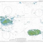
Admiralty Chart 3656 – Plateau des Minquiers and adjacent coast of France
Admiralty standard nautical charts comply with Safety of Life at Sea (SOLAS) regulations and are ideal for professional, commercial and recreational use. Charts within the series Read More » -

A Cloud a Day
The new book from the author of the bestselling `The Cloudspotter`s Guide`. Passionate cloud spotter and bestselling author Gavin Pretor-Pinney gives you a cloud a day Read More » -

United States NGS Classic Wall Map POSTER-SIZE PAPER
-

Landau a.d. Isar
Landau a.d.Isar in a series of GPS compatible recreational editions of the Bavarian topographic survey at 1:25,000, with waymarked hiking trails and cycling routes, campsites and Read More » -

Peppa Pig: Peppa the Easter Bunny
It`s Easter and Peppa and George are having an Easter egg hunt for their friends!Mummy and Daddy Pig help them paint all the colourful eggs and Read More » -

Dunkeld, Aberfeldy & Glen Almond OS Explorer Active Map 379 (waterproof)
Dunkeld, Aberfeldy and Glen Almond area on a detailed topographic and GPS compatible map No. 379, waterproof version, from the Ordnance Survey’s 1:25,000 Explorer series. MOBILE Read More » -

Amsterdam Tales
In this volume Paul Vincent presents a compelling collection of prose fiction, memoirs and anecdotes centring on Amsterdam from the seventeenth to the twenty-first century. His Read More » -

Ashdown Forest – Royal Tunbridge Wells, East Grinstead, Haywards Heath & Crowborough OS Explorer Map 135 (paper)
Ashdown Forest, Royal Tunbridge Wells, East Grinstead, Haywards Heath and Crowborough area on a detailed topographic and GPS compatible map No. 135, paper version, from the Read More »
-


