Disclosure : This site contains affiliate links to products. We may receive a commission for purchases made through these links.
Altmuhltal NP Central UK50-24
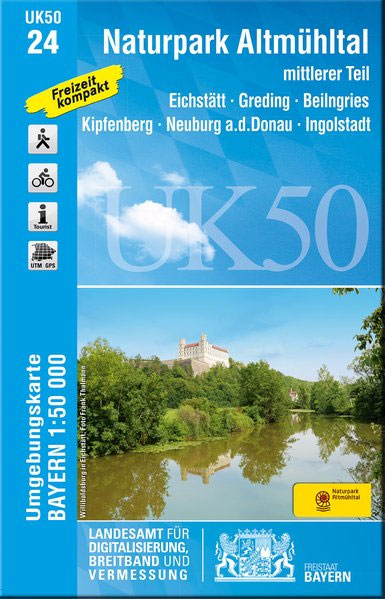
The middle part of the Altmรผhl Valley Regional Park, map no. 50-24, in a series of special contoured and GP-compatible recreational maps from the Bavarian state survey organization, with cartography of the German topographic survey at 1:50,000 and extensive additional tourist overprint highlighting waymarked hiking trails and cycling routes, campsites and youth hostels, etc.Maps in this series have cartography identical to the standard topographic survey of Germany. Topography is vividly presented by contours at 20m intervals, enhanced by bold shading and graphic relief, plus colouring and/or graphics to show forests and other types of vegetation.To see the other titles in this series please click on the series link.All the maps in this series, published by the state survey of Bavaria, have cartography identical to the standard topographic survey of Germany, plus extensive overprint highlighting local and long-distance footpaths and cycle routes, including King Ludwig Way or different variants of the Way of St James, indicating their waymarking. Symbols highlight different types of accommodation (campsites, youth hostels, refuges, etc), sport and recreational facilities, various places of interest, etc. The maps have a 1-km UTM grid. Many of the titles include on the reverse photos of fauna and flora and descriptions of the area covered by them. Map legend and all the text are in German only.To see other titles in this series please click on the series link.

Related Products:
 Altmuhltal NP West UK50-23
 Altmuhltal NP East UK50-25
 Spessart NP North UK50-06
 Oberpfรคlzer Wald NP UK50-20
 Hassberge Nature Park UK50-02
 Kaufbeuren UK50-39
 Tolzer Land – Starnberger See UK50-52
Allgau Alps UK50-47
Tolzer Land – Starnberger See UK50-52
Allgau Alps UK50-47
 Bavarian Rhon Nature Park UK50-01
Franconian Forest Regional Park UK50-04
Chiemsee – Chiemgau Alps UK50-54
Kneippland – Unterallgรคu – Kaufbeuren – Memmingen UK50-38
Pfaffenhofen a.d. Ilm – Neuburg-Schrobenhausen UK50-34
Inn-Salzach-Region – Rupertiwinkel – Eastern Chiemgau UK50-44
Bavarian Rhon Nature Park UK50-01
Franconian Forest Regional Park UK50-04
Chiemsee – Chiemgau Alps UK50-54
Kneippland – Unterallgรคu – Kaufbeuren – Memmingen UK50-38
Pfaffenhofen a.d. Ilm – Neuburg-Schrobenhausen UK50-34
Inn-Salzach-Region – Rupertiwinkel – Eastern Chiemgau UK50-44
 Franconia Lake District UK50-22
 Franconia Wineland – Wรผrzburg – Schweinfurt UK50-07
Lindau – Nature Park Nagelfluhkette UK50-45
Landshut – Dingolfing – Moosburg a.d. Isar – Mainburg – Rottenburg a.d.Laaber UK50-35
Franconia Wineland – Wรผrzburg – Schweinfurt UK50-07
Lindau – Nature Park Nagelfluhkette UK50-45
Landshut – Dingolfing – Moosburg a.d. Isar – Mainburg – Rottenburg a.d.Laaber UK50-35
 Ries – Nรถrdlingen – Dinkelsbรผhl – Hesselberg – Altmรผhlsee UK50-21
Coburg Land – Upper Maintal – Bamberg UK50-03
Ries – Nรถrdlingen – Dinkelsbรผhl – Hesselberg – Altmรผhlsee UK50-21
Coburg Land – Upper Maintal – Bamberg UK50-03
 Berchtesgaden Alps – Bad Reichenhall – Konigssee UK50-55
 Spessart NP South UK50-16
 Steigerwald Naturel Park Northern Section – Bamberg UK50-08
Munich East – Erding – Garching – Dorfen – Grafing – Markt Schwaben UK50-42
Karwendel – Garmisch-Partenkirchen – Lenggries – Murnau a.Staffelsee – Mittenwald UK50-51
Steigerwald Naturel Park Northern Section – Bamberg UK50-08
Munich East – Erding – Garching – Dorfen – Grafing – Markt Schwaben UK50-42
Karwendel – Garmisch-Partenkirchen – Lenggries – Murnau a.Staffelsee – Mittenwald UK50-51
 Pfaffenwinkel – Northern Ammergau Alps UK50-49
 Mangfallgebirge – Rosenheim – Bayrischzell – Inntal – Tegernsee – Schliersee UK50-53
 Hirschwald Nature Park – Amberg – Neumarkt i.d. OPf. – Sulzbach-Resenberg UK50-19
 Werdenfelser Land – Ammergau Alps – Fรผssen – Garmisch-Partenkirchen UK50-50
Augsburg NP – Western Forests UK50-32
Bavarian Forest National Park – Nature Park East UK50-29
Werdenfelser Land – Ammergau Alps – Fรผssen – Garmisch-Partenkirchen UK50-50
Augsburg NP – Western Forests UK50-32
Bavarian Forest National Park – Nature Park East UK50-29
 Altmรผhl Valley Regional Park: central part
 Ulm – Neu-Ulm – Gรผnzburg
Germany: Bavarian 50K Topographic Survey Leisure Maps
Ulm – Neu-Ulm – Gรผnzburg
Germany: Bavarian 50K Topographic Survey Leisure Maps
 Naturpark Frankenhohe
 Dingolfing – Landau
 Ammersee – Starnberger See – Munich South
Hof – Selb – As – Mรผnchberg – Naila – Rehau
Ammersee – Starnberger See – Munich South
Hof – Selb – As – Mรผnchberg – Naila – Rehau
 Kempten and the Surrounding Area
 Fichtelgebirge Regional Park West