Disclosure : This site contains affiliate links to products. We may receive a commission for purchases made through these links.
Alt Pirineu Natural Park Editorial Alpina
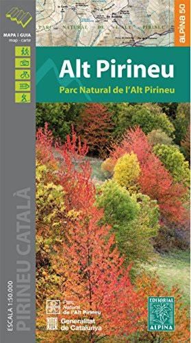
Alt Pirineu Natural Park in the Catalan Pyrenees on a contoured and GPS compatible map at 1:50,000 from Editorial Alpina. Coverage extends northwards from La Seu d’Urgell and Sort beyond the French border to Aulus-les-Bains. Accompanying booklet includes an extensive list of contact details for various types of local accommodation.The map has contours at 20m intervals, enhanced by relief shading with plenty of spot heights, plus colouring for different types of vegetation and/or land use. An overprint highlights walking trails, indicating where appropriate GR numbers of long-distance paths and the TRF (trans-frontier) routes. The map also shows recommended mountain bike trails. Symbols indicate various accommodation options (hotels, farms, refuges, campsites, etc), restaurants, nature centres and museums, etc. Local roads show car parks and locations of petrol stations. The map has a 5km UTM grid. Map legend includes English. Accompanying booklet with descriptions of recommended walks and more strenuous mountain climbs is in Catalan only, but includes an extensive list of contact details of local accommodation, recreational services, taxis, etc.To see the list of currently available titles in this extensive Editorial Alpina hiking series please click on the series link.

Related Products:
 Cabo de Gata-Nรญjar Natural Park Editorial Alpina
 Cap de Creus Park Natural Editorial Alpina
 Posets-Maladeta Natural Park 2-Map Set Editorial Alpina
 Cavalls del Vent – Cadi-Moixero Natural Park Hiking Circuit Editorial Alpina
 Sierra Nevada – La Alpujarra Editorial Alpina
 Serralada de Marina Editorial Alpina
Ordesa and Monte Perdido National Park Editorial Alpina
Serralada de Marina Editorial Alpina
Ordesa and Monte Perdido National Park Editorial Alpina
 Serra del Cadรญ – Pedraforca Editorial Alpina
 Costabona – Alta Val de Ter Editorial Alpina
 Aigรผestortes and Estany de Sant Maurici National Park 2-Map Set Editorial Alpina
 Mallorca – Tramuntana Central Editorial Alpina
 Moixerรณ – La Tosa – Cadรญ-Moixerรณ Natural Park Editorial Alpina
 Mallorca – Tramuntana South Editorial Alpina
Ordesa – Monte Perdido National Park Editorial Alpina 2-Map Set
Mallorca – Tramuntana South Editorial Alpina
Ordesa – Monte Perdido National Park Editorial Alpina 2-Map Set
 Mallorca – Tramuntana North Editorial Alpina
 Vall de Lord – Port del Comte Editorial Alpina
 Ordesa and Monte Perdido National Park 2-Map Set Editorial Alpina
 Taga – Serra Cavallera Editorial Alpina
Montserrat Nature Park Editorial Alpina
Vall de Boรญ – Aigรผestortes PN Editorial Alpina
Taga – Serra Cavallera Editorial Alpina
Montserrat Nature Park Editorial Alpina
Vall de Boรญ – Aigรผestortes PN Editorial Alpina
 Montgrony – Fonts del Llogregat – Parc Natural del Cadรญ-Moixerรฒ Editorial Alpina
 Serra de Tramuntana Editorial Alpina 4-Map Set
 Garrotxa – Zona Volcanica Editorial Alpina
 Sant Maurici Editorial Alpina
Cotiella ‘“ Peรฑa Montaรฑesa Editorial Alpina
Sant Maurici Editorial Alpina
Cotiella ‘“ Peรฑa Montaรฑesa Editorial Alpina
 Alta Garrotxa – Comanegra – Bassegoda – el Mont Editorial Alpina
Collserola Parc Natural Editorial Alpina
Alta Garrotxa – Comanegra – Bassegoda – el Mont Editorial Alpina
Collserola Parc Natural Editorial Alpina
 Pica d`Estats – Mont-roig Editorial Alpina
 Sierra de Gredos – Almanzor – Laguna Grande Editorial Alpina
Montnegre – Corredor Editorial Alpina
Valle de Tena – Panticosa – Partacua – Sallent Editorial Alpina
Sierra de Gredos – Almanzor – Laguna Grande Editorial Alpina
Montnegre – Corredor Editorial Alpina
Valle de Tena – Panticosa – Partacua – Sallent Editorial Alpina
 Andorra – Comapedrosa – Engorgs – Jucla – Pessons – Tristaina Editorial Alpina
 Aneto – Maladeta – PN Posets Editorial Alpina
 Pica d`Estats – Mont-roig – Vall Ferrera – Valls de Cardos Editorial Alpina
 La Senda de Camille Editorial Alpina
Bachimala – Valles de Chistau y Bielsa Editorial Alpina
Vall de Barravรฉs – Ribagorรงa Editorial Alpina
Cingles de Berti – Sant Miquel des Fai Editorial Alpina
La Senda de Camille Editorial Alpina
Bachimala – Valles de Chistau y Bielsa Editorial Alpina
Vall de Barravรฉs – Ribagorรงa Editorial Alpina
Cingles de Berti – Sant Miquel des Fai Editorial Alpina
 Picos de Europa National Park 2-Map Set Editorial Alpina