Disclosure : This site contains affiliate links to products. We may receive a commission for purchases made through these links.
Alt Empordรก 2-Map Set Editorial Alpina
Alta Empordรก administrative district on the Costa Brava at 1:50,000 in a set of two contoured and GPS compatible maps from Editorial Alpina highlighting local and long-distance waymarked hiking trails, different types of accommodation, etc. Coverage of the whole area is conveniently divided east-west; one map shows the coastal region from Banylus-sur-Mer in France across Cap de Creus and Roses to l’Escala and inland to Figueres ‘“ the other sheet covers the area to the west of the E-15 motorway, with both sides of the border and south to Banyoles.Topography is presented by contours at 20m intervals with light relief shading and plenty of names of peaks, passes, etc, plus colouring for different types of vegetation. The map shows local tracks and footpaths, with an overprint highlighting waymarked trails, including the PR and GR routes. Symbols indicate various types of accommodation including summer caps, campsite, mountain refuges, picnic sites and car parks, remarkable trees, etc. The map has a 5-km UTM grid. Map legend includes English.To see the full list of titles in this very popular series covering the Pyrenees and other hiking areas of Spain, please click on the series link.

Related Products:
 Caps del Nord – Mallorca Editorial Alpina 2-Map Set
 Cap de Creus Park Natural Editorial Alpina
 Vall de Lord – Port del Comte Editorial Alpina
 Taga – Serra Cavallera Editorial Alpina
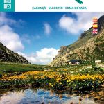 Travessa 3 Refugis – Caranรงร – Ulldeter – Coma de Vaca Editorial Alpina
 Mallorca – Tramuntana North Editorial Alpina
 Puigmal – Vall de Nuria – Ulldeter Editorial Alpina
 Mallorca – Tramuntana South Editorial Alpina
 Serra de Tramuntana Editorial Alpina 4-Map Set
 Mallorca – Tramuntana Central Editorial Alpina
 Alta Garrotxa – Comanegra – Bassegoda – el Mont Editorial Alpina
 Pica d`Estats – Mont-roig Editorial Alpina
 Garrotxa – Zona Volcanica Editorial Alpina
 Ibiza – Formentera Editorial Alpina
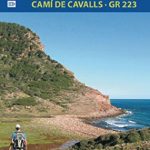 Menorca – Camรญ de Cavalls – GR223 Editorial Alpina CATALAN
 Pica d`Estats – Mont-roig – Vall Ferrera – Valls de Cardos Editorial Alpina
 Alt Pirineu Natural Park Editorial Alpina
 Guadarrama – La Pedriza 2-Map Set Editorial Alpina
 Menorca – Camรญ de Cavalls – GR223 Editorial Alpina ENGLISH
Bachimala – Valles de Chistau y Bielsa Editorial Alpina
Menorca – Camรญ de Cavalls – GR223 Editorial Alpina ENGLISH
Bachimala – Valles de Chistau y Bielsa Editorial Alpina
 Montnegre – Corredor Editorial Alpina
 Sobrarbe Central – Ainsa – Boltana Editorial Alpina
Vall de Barravรฉs – Ribagorรงa Editorial Alpina
Sobrarbe Central – Ainsa – Boltana Editorial Alpina
Vall de Barravรฉs – Ribagorรงa Editorial Alpina
 Cabo de Gata-Nรญjar Natural Park Editorial Alpina
Sierra Nevada – La Alpujarra Editorial Alpina
Cabo de Gata-Nรญjar Natural Park Editorial Alpina
Sierra Nevada – La Alpujarra Editorial Alpina
 Montseny Editorial Alpina
 Valles de Belagua y Roncal Editorial Alpina
 Serra del Cadรญ – Pedraforca Editorial Alpina
 Montseny NP – Turo de l`Home – Les Agudas – Matagalls – la Calma Editorial Alpina 2-Map Set
 Mallorca North Walking & Cycling Map & Guide Editorial Alpina
Cingles de Berti – Sant Miquel des Fai Editorial Alpina
Puigsacalm – Bellmunt Editorial Alpina
Sant Llorenc del Munt i l`Obac Editorial Alpina
Mallorca North Walking & Cycling Map & Guide Editorial Alpina
Cingles de Berti – Sant Miquel des Fai Editorial Alpina
Puigsacalm – Bellmunt Editorial Alpina
Sant Llorenc del Munt i l`Obac Editorial Alpina
 Vall de Boรญ – Aigรผestortes PN Editorial Alpina
Ordesa and Monte Perdido National Park Editorial Alpina
Vall de Boรญ – Aigรผestortes PN Editorial Alpina
Ordesa and Monte Perdido National Park Editorial Alpina
 Ripollรจs Editorial Alpina
 Muntanya d’Alinyร Editorial Alpina
 Posets-Maladeta Natural Park 2-Map Set Editorial Alpina
 Ordesa and Monte Perdido National Park 2-Map Set Editorial Alpina
Valle de Tena – Panticosa – Partacua – Sallent Editorial Alpina
Ordesa and Monte Perdido National Park 2-Map Set Editorial Alpina
Valle de Tena – Panticosa – Partacua – Sallent Editorial Alpina