Disclosure : This site contains affiliate links to products. We may receive a commission for purchases made through these links.
Alpi Apuane – Versilia – Garfagnana 4Land Cartography
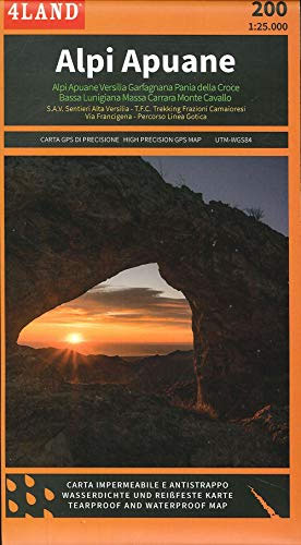
Apuan Alps on a large, double-sided, contoured and GPS compatible map at 1:25,000 from 4Land Cartography, with excellent presentation of the topography and printed on light, waterproof and tear-resistant synthetic paper. Coverage extends from Forte dei Marmi in the south-western corner of the map eastwards and northwards to cover the most popular hiking areas of north-western Tuscany.Contours at 20m intervals enhanced by bold relief shading plus plenty of spot heights provide a vivid picture of the terrain. An overprint shows local and long-distance trails, indicating for waymarked routes their official number, also difficult and/or Via Ferrata sections. The region’s best know long-distance trails are prominently highlighted, including Garfagnana Trekking, Sentiero Alta Versilia and Apuane Trekking. A wide range of symbols indicates various facilities and places of interest, including different types of accommodation (campsites, huts, farms, etc), sites for recreational pursuits (climbing, paragliding, etc), archaeological and cultural locations, etc. The map has a 1km UTM grid plus latitude and longitude margin ticks at 1’ intervals. Map legend includes English.

Related Products:
 Versilia – Massa – Carrara – Alpi Apuane Global Map Tourist Map
 Versilia – Riviera Apuana – Alpi Apuane Edizioni Multigraphic 711
 Alpi Apuane Edizioni Multigraphic 101/102
 Versilia TCI Smart Map
 Appenninno Reggiano – Alta Garfagnana Edizioni Multigraphic 16
 Alpi Feltrine – La Vรจtte – Cimรฒnega Tabacco 023
 Alpi Carniche – Carnia Centrale Tabacco 09
 Alpi Giulie Occidentali – Tarvisiano Tabacco 019
 Mercantour & Alpi-Marittime Didier Richard 07
 Alpi Carniche Orientali – Canal del Ferro – Nassfeld Tabacco 018
 Dolomites 4-Map Set Kompass 672
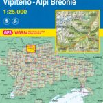 Vipiteno / Sterzing – Alpi Breonie / Stubaier Alpen Tabacco 038
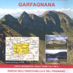 Appennino Modenese – Garfagnana Edizione Multigraphic 18
 Appennino Reggiano – Lunigiana – Garfagnana Edizioni Multigraphic 15
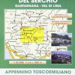 Media Valle del Serchio – Garfagnana – Val di Lima Edizioni Multigraphic 20
 Valle Gesso – Parco Naturale delle Alpi Marittime
 Alta Val Tanaro – Alta Valle Arroscia – Alta Valle Argentina
 Alta Val Venosta / Vinschgauer Oberland Tabacco 043
 Alta Badia – Arabba – Marmolada Tabacco 07
 Alpi di Ledro – Valli Giudicarie Kompass 071
 Alta Val Tiberina
Alta Val Marecchia
Alta Val Tiberina
Alta Val Marecchia
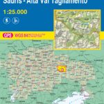 Forni di Sopra – Ampezzo – Sร uris – Alta Val Taglimento Tabacco 02
 Walks and Treks in the Maritime Alps: The Mercantour and Alpi Maritimi Parks
 Garfagnana Edizioni Multigraphic 701
 Alta Valle del Lamone 22
 Alta Valle del Santerno 23
 Alta Valle Susa – Alta Val Chisone Fraternali Editore 02
Alpi Orobie Bergamasche – Valle Brembana – Valle Seriana Kompass 104
Alta Valle Susa – Alta Val Chisone Fraternali Editore 02
Alpi Orobie Bergamasche – Valle Brembana – Valle Seriana Kompass 104
 Alta Val Varaita
 Alta Valle Maira
Alta Valle del Metauro: Valle del Candigliano, Monte Nerone, Monte Catria
Alta Valle Maira
Alta Valle del Metauro: Valle del Candigliano, Monte Nerone, Monte Catria
 Alta Valle Stura di Demonte
 Val Vermenagna – Valle Pesio – Alta Valle Ellero
 Alta Valle Susa – Bardonecchia – Oulx Fraternali Editore 01
 Alpi Bellunesi Kompass 77
 Bรฉarn – Aspe – Ossau – Pyrenees National Park Rando Editions 3
 Pays Basque East Rando Editions 2
 Mont Blanc Massif IGC 4