Disclosure : This site contains affiliate links to products. We may receive a commission for purchases made through these links.
Albany City & County, NY
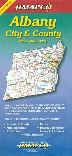
Albany, NY on a double-sided map from Jimapco combining a street plan of the city and its immediate surroundings with a more detailed enlargement of downtown Albany, plus a road map Albany County covering of a wider region around the city.On one side is a street plan of Albany at 1:28,000, with coverage including Colonie, Cohoes, Watervliet, Menands and Rensselar. The plan indicates various facilities and services including academic institutions, campgrounds, sport and recreational sites, etc. Albany’s downtown area is also shown in much greater detail on an accompanying enlargement at 1:10,500.On the reverse is a road map of the Albany County at 1:86.000 showing, as appropriate, road numbers or names. The combined index for the street plan and the road map includes a list of points of interest.


