Disclosure : This site contains affiliate links to products. We may receive a commission for purchases made through these links.
Albania ITMB
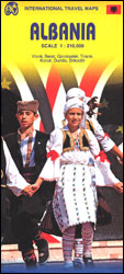
Albania at 1:210,000 on an indexed, double-sided map from ITMB with street plans of Tirana, Gjirokaster, Berat, Vlore, Durres, Shkoder and Korce. The map divides the country north/south, with a good overlap between the sides, and presents its topography by altitude colouring, with names of mountain ranges, peaks, etc. National parks and other protected areas are highlighted.Road network includes selected tracks and seasonal roads, shows locations of border crossings and gives distances on main routes. Railway lines are included and the map also shows internal administrative boundaries and names of the provinces. Symbols mark various places of interest. Each side has a separate index. Latitude and longitude lines are drawn at 30’. Seven insets provide street plans of the country’s main towns, indicating principal traffic arteries, naming main and selected smaller streets, and highlighting selected tourist accommodation and various places of interest.

Related Products:
 Peru ITMB
 Colombia ITMB
 Algeria ITMB
 Togo & Benin ITMB
 Cuba ITMB
 Mauritius & Reunion ITMB
 Romania & Moldova ITMB
 Mongolia ITMB
 Malawi Map Studio Adventure Map
 Senegal & Gambia ITMB
 Tanzania ITMB
 Taiwan & Taipei ITMB
 Middle East ITMB Travel Atlas
 Belarus ITMB
 Bangladesh & India East ITMB
 Albania F&B Top 10 Tips
 Quito & Central Ecuador ITMB
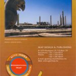 Iran Gizi Map
 Argentina South & Tierra del Fuego ITMB
 Venezuela ITMB
 Thailand, Vietnam, Laos & Cambodia ITMB Travel Atlas
 Nigeria & Niger ITMB
 Ghana ITMB
 Iran Wall Map
 Qatar and Doha City ITMB
 Japan North & Hokkaido ITMB
 Madagascar ITMB
 Oman & Yemen ITMB
 Guyana, Suriname & French Guiana ITMB
 Kilimanjaro & Tanzania North ITMB
 Morocco ITMB
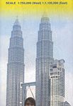 Malaysia ITMB
Sri Lanka & India South ITMB
Malaysia ITMB
Sri Lanka & India South ITMB
 Hungary & Budapest ITMB
 Tehran & Northern Iran ITMB
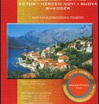 Montenegro & North Albania Gizi Map
 Bhutan & Northeast India ITMB
 Japan South ITMB Railway & Road Map