Disclosure : This site contains affiliate links to products. We may receive a commission for purchases made through these links.
Aland – Ahvenanmaa Tourist Map
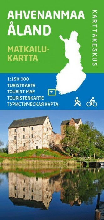
ร…land (Ahvenanmaa) and the neighbouring islands off the south-west coast of Finland on a detailed touring and recreational map at 1:150,000 from the Finnish national survey organization Karttakeskus, with a street plan of Mariehamn (Maarianhamina).Road information includes what is confusingly described in the map legend as ‘private” roads; these are unsurfaced roads, open to the general public but simply privately maintained. An overprint for cycle routes indicates surfaced and unsurfaced routes, and local nature trails are marked. A wide range of symbols indicates different types of tourist accommodation including campsites and youth hostels, museums, sport and recreational facilities, local shops and petrol stations, etc. The map also shows ferry connections between the islands and with the mainland. The map has a UTM grid plus latitude and longitude lines .Map legend includes English.Also provided is a plan of Mariehamn (Maarianhamina) indicating cycling routes across the town.

Related Products:
 Lake Garda Global Map Tourist Map
 Elba Global Map Tourist Map
 Finland South Karttakeskus Road Map
 Swietokrzyskie Mountains ExpressMap Tourist Map
Klodzko Environs ExpressMap Tourist Map
Swietokrzyskie Mountains ExpressMap Tourist Map
Klodzko Environs ExpressMap Tourist Map
 Borzsony Cartographia Tourist Map 5
 Bรผkk Cartographia Tourist Map 29
 Vรฉrtes Cartographia Tourist Map 20
 New Zealand F&B
Finland East Karttakeskus Road Map
New Zealand F&B
Finland East Karttakeskus Road Map
 Mรกtra Cartographia Tourist Map 14
 Iceland F&B
 Zselic Cartographia Tourist Map 17
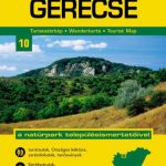 Gerecse Cartographia Tourist Map 10
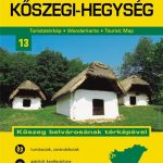 Koszeg Hills Cartographia Tourist Map 13
Kurzeme North Jana Seta Tourist Map
Gemenc – Szekszard-Hills Tourist Map
Finland North Karttakeskus Road Map
Koszeg Hills Cartographia Tourist Map 13
Kurzeme North Jana Seta Tourist Map
Gemenc – Szekszard-Hills Tourist Map
Finland North Karttakeskus Road Map
 Cserhat – Karancs – Medves Cartographia Tourist Map 8
 Buda Hills Cartographia Tourist Map 6
 Vidzeme North Jana Seta Tourist Map
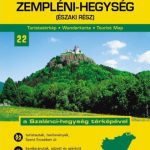 Zemplen Hills North Cartographia Tourist Map 22
Pilis – Visegrad Hills Cartographia Tourist Map 16
Nadmorski Regional Park – Hel Peninsula ExpressMap Tourist Map
Zemplen Hills North Cartographia Tourist Map 22
Pilis – Visegrad Hills Cartographia Tourist Map 16
Nadmorski Regional Park – Hel Peninsula ExpressMap Tourist Map
 Orsรฉg – Gรถcsej – Kemeneshat Cartographia Tourist Map 21
 Finland West Karttakeskus Road Map
 Danube Bend Cartographia Tourist Map 31
Sudetes East ExpressMap Tourist Map
Danube Bend Cartographia Tourist Map 31
Sudetes East ExpressMap Tourist Map
 Mecsek – Villรกny Mountains Cartographia Tourist Map 15
 Latgale South Jana Seta Tourist Map
 Gรณry Stolowe ExpressMap Tourist Map
 Zemplen Hills South Cartographia Tourist Map 23
 Kurzeme South Jana Seta Tourist Map
 Vidzeme East – Latgale North Jana Seta Tourist Map
 Central Latvia Jana Seta Tourist Map
 Lake Balaton Cartographia Tourist Map 4
 Tatra Mountains ExpressMap Tourist Map
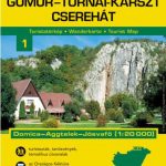 Gรถmรถr – Tornai-Karszt – Cserehรกt Cartographia Tourist Map 1
Denmark Tourist Map – Major Cities with the Marguerite Route
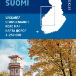
Finland: Karttakeskus 250/400K GT Road Maps
Gรถmรถr – Tornai-Karszt – Cserehรกt Cartographia Tourist Map 1
Denmark Tourist Map – Major Cities with the Marguerite Route
Finland: Karttakeskus 250/400K GT Road Maps