Disclosure : This site contains affiliate links to products. We may receive a commission for purchases made through these links.
Africa`s Highest Peaks – Kilimanjaro – Mount Kenya – Rwenzori terraQuest Trekking Map
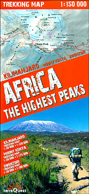
Three of Africa’s most popular trekking regions: Kilimanjaro, Mount Kenya and the peaks of the Ruwenzori National Park on a durable, waterproof and tear-resistant map from terraQuest. Each destination is presented on two panels: a general map of the area plus an enlargement of the highest part at 1:50,000.On one side is coverage of Kilimanjaro. The general map at 1:150,000 extends eastwards to include Arusha with the Arusha National Park and Mt Meru. The enlargement covers the peak of Kibo between the Umbwe Cave Camp on the southern approaches and Second Cave Camp along the northern Rongai Route.On the reverse are four panels. The Mount Kenya area within the ring road linking the main tourist centres around the mountain is shown at 1:175,000, with an enlargement for the approaches to the summit. The Ruwenzori panel at 1:100,000 covers the National Park on the Ugandan side of the border and extends east to Kasese. The enlargement shows the highest part of the mountains with the approaches to Mount Margherita, Mount Alexandra, Mount Speke and Mount Baker.Both the general maps and the enlargements are contoured and have relief shading plus colouring and/or graphics to indicate different types of terrain and vegetation. Coverage by glaciers shows the present extent and the area covered around 1900. Trekking routes are highlighted and, where appropriate, named. Symbols indicate locations of hotels, mountain huts and bivouac sites, ranger stations, medical services, bus services, etc. The general maps of the Kilimanjaro and Mt Kenya areas show a large number of local villages with the connecting network of roads and local tracks. All the panels have latitude and longitude grid at intervals of 1’. Multilingual map legend includes English.The map is laminated in a format similar to the old cloth-dissected maps so that sections of it can be easily folded back without damage.

Related Products:
 Turkey`s Highest Peaks – Mount Ararat – Kackar Mountains – Mount Suphan terraQuest Trekking Map
 Snow on the Equator: Mount Kenya, Kilimanjaro and the Great African Odyssey
 Kilimanjaro: includes Mount Meru & guides to Arusha, Moshi, Marangu, Nairobi & Dar es Salaam
 Mount Kenya National Park Alpenverein 0/16
 Kilimanjaro National Park
 Kilimanjaro – Arusha F&B
 Kilimanjaro – Kibo
 Explore Mount Kilimanjaro
 Kilimanjaro: Ascent preparations, practicalities and trekking routes to the `Roof of Africa`
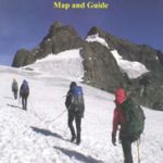
 Mount Kenya Map & Guide
 Kilimanjaro – Summit of Africa
 No Picnic on Mount Kenya
 Kilimanjaro: A Photographic Journey to the Roof of Africa
 Georgian Caucasus – Mt Ushba – Shkhara – Kazbek terraQuest Trekking Map
 Kilimanjaro & Northern Tanzania Footprint Handbook
 Mount Everest 50th Anniversary NGS Wall Map
 Mount Elgon
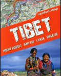 Tibet – Mount Everest – Nam Tso – Lhasa – Shigatse terraQuest Tourist Map
 Kenya F&B
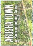 Arusha Town and Surrounding Area
 Kenya Marco Polo Road Map
 Fodor`s the Complete Guide to African Safaris: with South Africa, Kenya, Tanzania, Botswana, Namibia, Rwanda, Uganda, and Victoria Falls
 Mount Qomolangma (Sagarmatha/Mount Everest)
 Rwenzori Mountains
 Kilimanjaro & Tanzania North ITMB
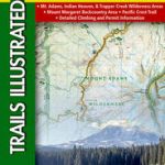 Mount St Helens – Mount Adams – Gifford-Pinchot National Forest WA
 National Geographic Mount Everest 50th Anniversary Side 1 805 X 526 mm
 Aconcagua terraQuest Trekking Map
 Karakoram – K2 – Gasherbrum – Broad Peak terraQuest Trekking Map
 Hiking and Trekking in the Japan Alps and Mount Fuji: Northern, Central and Southern Alps
 Tilting at Mountains: Overcoming Personal Demons to Climb the World`s Highest Peaks
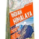 Indian Himalaya terraQuest Trekking Map
 Central Pyrenees terraQuest Trekking Map
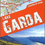 Lake Garda terraQuest Trekking Map
 Lake Como terraQuest Trekking Map
 Insight Guides Kenya
Kenya – Serengeti Nelles
Insight Guides Kenya
Kenya – Serengeti Nelles
 Munros and Corbetts Collins Pocket Map – Discover Scotland`s highest peaks
 The Rough Guide to Kenya