Disclosure : This site contains affiliate links to products. We may receive a commission for purchases made through these links.
Africa North ITMB
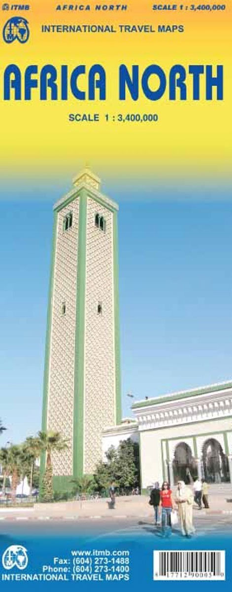
Northern Africa at 1:3,400,000 on an indexed, double-sided map from ITMB with topography presented by altitude colouring. The map divides the region east/west with a tiny overlap between the sides, extending from the Atlantic coast of Western Sahara to Sinai and the Red Sea coast of Egypt. On its western side coverage extends just south of the Bordj Mokhtar border crossing between southern Algeria and Mali, whilst its eastern part goes further south to approx. 19ยบS to include the Tibesti Mountains in Chad and the Nile just short of the 6th Cataract in Sudan.Topography is presented by altitude colouring (without a colour bar and without spot heights), although the maps does show names of various mountain ranges, as well as locations of numerous water wells and oases. Selected national parks are highlighted. The map shows the network of roads and selected desert tracks with border crossings and distances marked on main routes. Symbols indicate various places of interest. The map has latitude and longitude lines at 5ยบ intervals. Each side has a separate index.To see other titles in this series please click on the series link.

Related Products:
 Africa North-East ITMB
 Africa Northwest ITMB
 Africa Western ITMB
 Africa East & Central ITMB
 Cape Verde & West Africa ITMB
 Africa South & Central ITMB
 South America North ITMB
 Santiago & Chile North ITMB
 Africa Equatorial ITMB
 Chile South & Patagonia ITMB
 South America Southern ITMB
 South America ITMB
 Africa Southern ITMB
 Scotland ITMB
 US / Mexico Border ITMB
 Argentina South & Tierra del Fuego ITMB
 San Francisco & Northern California ITMB
 India North and West ITMB
 South America: ITMB Sectional Maps
 San Diego & USA South West Border ITMB
 Africa ITMB
 Albania ITMB
 Vietnam, Laos & Cambodia ITMB
 Patagonia & Tierra del Fuego ITMB
 Alaska ITMB
 South East Asia ITMB
 Togo & Benin ITMB
 Hanoi – Vietnam North ITMB
 Great Lakes ITMB
 Ghana ITMB
 Kilimanjaro & Tanzania North ITMB
 Africa Map Studio Road Atlas
 USA Southwest ITMB
 Rocky Mountains Canada and US ITMB
 Central Asia ITMB
 Buenos Aires & Argentina North East ITMB
 Philadelphia & Mid-Atlantic States ITMB
 Turkey South Coast ITMB
 Mongolia ITMB