Disclosure : This site contains affiliate links to products. We may receive a commission for purchases made through these links.
Africa Equatorial ITMB
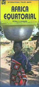
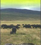
Equatorial Africa at 1:3,400,000 on an indexed, double-sided map from ITMB providing coverage of the whole of Congo (Brazaville), Equatorial Guinea, Democratic Republic of Congo (Kinshasa), Uganda, Rwanda, Burundi, Kenya, Tanzania, Zambia and Angola. Coverage extends from approximately 6ยบ north of the Equator southwards to the Caprivi Strip in Namibia and the southern tip of Zambia, plus in East Africa to the southern border of Tanzania and Lilongwe in Malawi.Topography is presented by altitude colouring with spot heights and names of main mountain ranges. National parks are highlighted. The map shows the network of roads and selected tracks with border crossings. Regional airports are marked and within the Congo Basin locations accessible by water transport. Symbols indicate various places of interest. The map has latitude and longitude lines at 5ยบ intervals and is indexed.To see other titles in this series please click on the series link.

Related Products:
 Africa Southern ITMB
 Africa North-East ITMB
 Africa East & Central ITMB
 Africa North ITMB
 Africa South & Central ITMB
 Africa Northwest ITMB
 Africa Western ITMB
 Cape Verde & West Africa ITMB
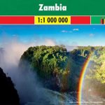
 Zambia & Eastern Africa ITMB Road Map
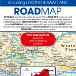
 South Africa – Lesotho – Swaziland ITMB
 Africa Southern Reise Know-How
 Africa Map Studio Road Atlas
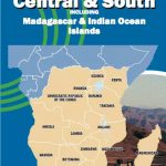 Africa Central & South Map Studio
 South Africa Tracks4Africa
 South Africa – Namibia – Botswana Hallwag Road Map
 Africa: Eye on Africa – Thirty Years of Africa Images, Selected by Salgado Himself
 4×4 Routes Through Southern Africa
 Africa Lonely Planet Planning Map
 Cameroon & Gabon ITMB
 South Africa – Lesotho & Swaziland Map Studio
 Argentina South & Tierra del Fuego ITMB
 Kilimanjaro & Tanzania North ITMB
 Africa West – Coastal Countries Reise Know-How
 Africa Overland – Cairo to Cape Town ITMB Travel Atlas
 Zambia F&B
 Southern Africa: South Africa – Swaziland – Nambia – Botswana – Zambia
 Algeria ITMB
 Stuart`s field guide to mammals of southern Africa: Including Angola, Zambia & Malawi
 South Africa – Namibia – Botswana – Zimbabwe Nelles
 Africa West – Sahara Reise Know-How
 Belarus ITMB
 Mexico Border States: Coahuila, Nuevo Leon, Tamaulipas ITMB
 Africa: Birding Map of Southern Africa
 Senegal & Gambia ITMB
 Munich & Bavaria ITMB
 Patagonia & Tierra del Fuego ITMB
 Africa: ITMB Sectional Maps
 Africa ITMB
 Equatorial Guinea Bradt Guide