Disclosure : This site contains affiliate links to products. We may receive a commission for purchases made through these links.
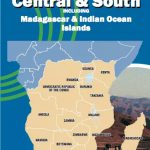
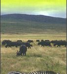
Africa Central & South – Madagascar Michelin
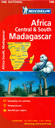
Central and Southern Africa at 1:4,000,000 – paper version – in Michelin’s series covering the continent on three maps excellent for long-distance overland traveling or route planning, with detailed road classification, plenty of geographical features and a very comprehensive climate chart listing several locations. Coverage starts north of Yaoundรฉ in Cameroon, Bangui in the Central African Republic and Juba in South Sudan.Road detail distinguishes various classes of road surface, e.g. improved, partially-improved, earth roads and tracks, with the maps also providing definitions of these terms and their implications for travel. Difficult or seasonally impassable roads (shown with times of the year), prohibited roads and scenic routes are indicated, as well as vehicle ferries across rivers with load limit, toll barriers and customs posts on border crossings. Intermediate distances in miles and kilometres are marked on many routes. Railway lines and local airports are included.Topography is well presented by subtle relief shading plus colouring and or graphics for deserts, oasis, water holes, densely forested areas, seasonal rivers and lakes, marshland and areas liable to flooding, etc. Plenty of names of geographical features are provided: deserts, mountain ranges, peaks, etc. National parks are marked, indicating those with camping facilities. In most countries the maps also show internal administrative boundaries with names of the provinces.Symbols mark selected tourist accommodation. Also included are petrochemical pipelines and mining sites for various metals, gold and silver, etc. Latitude and longitude lines are drawn at 4ยฐ intervals. Multilingual map legend includes English. Each map also has a very comprehensive climatic chart showing maximum and minimum daily temperature and rainfall for each month in several locations, all highlighted on the map.Please note: this title is also available from Stanfords in a waterproof and tear-resistant laminated version.

Related Products:
 Africa Central & South – Madagascar WATERPROOF
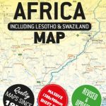
 Africa: Michelin Sectional Maps
 Africa Central & South Map Studio
 South Africa – Namibia – Botswana Hallwag Road Map
 Italy Central Michelin Regional 563
 South Africa – Namibia – Botswana Marco Polo Map
 Africa East & Central ITMB
 South Africa F&B
 South Central USA 07 Hallwag Road Map
 Central Asia F&B
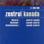 Canada Central: Western Ontario, Manitoba, Saskatchewan Reise-Know-How Map
 South Africa Giant Road Map
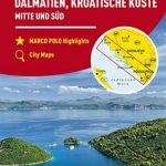 Dalmatia – Croatia Coast Central and South
 Brazil Central and South Nelles
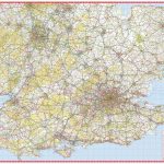 South East & Central England A-Z Wall Map PAPER
 Central Asia Geographical Edition Wall Map
 Massif Central Michelin Zoom 130
 Wales – South West England – Midlands Michelin Regional 503
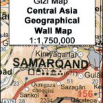
 Central Asia Geographical Edition Gizi Map
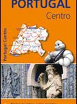 Portugal Central Michelin Regional 592
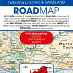
 Central Asia Road Edition Wall Map
 Central Asia (Road Edition)
 South East England – Midlands – East Anglia Michelin Regional 504
 Central Silesia Hรถfer Road Map
 South Africa – Lesotho & Swaziland Map Studio
 Africa South & Central ITMB
 Italy South Michelin Regional 564
 Central France Michelin Regional 518
 Africa Cape to Cairo Map Studio
 Central Bohemia
 Central Wielkopolska
 Belgium South Michelin Regional 534
 Central Macedonia Terrain Editions Regional Map 2
 South Africa – Namibia – Botswana – Zimbabwe Nelles
 USA South-Central: Kansas – Oklahoma – Texas Reise-Know-How Map
 Central Norway: Trondheim – Mo i Rana
 Central Norway: Dombas – Trondheim – Namsos – Mo i Rana
 South Africa Map Studio Road Atlas A4 PAPERBACK
 Central and North Norway: Bodรธ – Lofoten
 Madagascar ITMB