Disclosure : This site contains affiliate links to products. We may receive a commission for purchases made through these links.
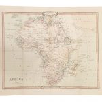
Africa c.1880 SMALL
Small size cloth-backed version of a reproduction by Old Folding Maps of Edward Mogg`s ‘Stranger`s Guide to London, Exhibiting all the various Alterations & Improvements complete to the Present Time” published in January 1837. The map shows London with ‘a list of 500 of the principal places with references to their situation on the above plan”. Main streets and green spaces are coloured in, and the map also shows the boundary of the City of London. Coverage roughly: most of Regent’s Park – Pentonville Road – Hackney; Stepney ‘“ Surrey Docks; Kennington including part of The Oval; Royal Chelsea Hospital ‘“ most of Hyde Park. A hand-written note in the north-west margin ‘Dorset Square, I have marked +, it is in this corner” add a personal touch from one of the map’s previous users.Each cloth-backed individual map is presented folded in a colourful case covered with a unique design marbled paper ‘“ no two cases are identical.Please note: this title is also available in a larger size. To see the list of all the titles in this series from the Old Folding Maps please click on the series link.

Related Products:
 Africa c.1880 MEDIUM
 Africa c.1841 SMALL
 London: Froggets 30 miles round London MEDIUM
Basin Of The Mediterranean Map MEDIUM
Australia c. 1895 MEDIUM
Basin Of The Mediterranean Map SMALL
Australia c. 1895 SMALL
London: Froggets 30 miles round London MEDIUM
Basin Of The Mediterranean Map MEDIUM
Australia c. 1895 MEDIUM
Basin Of The Mediterranean Map SMALL
Australia c. 1895 SMALL
 Mogg`s Strangers Guide to London c.1837
United Kingdom Steam Navigation Map MEDIUM
London: Edward Mogg`s 24 Miles c. 1851 MEDIUM
United Kingdom Steam Navigation Map SMALL
Mogg`s Strangers Guide to London c.1837
United Kingdom Steam Navigation Map MEDIUM
London: Edward Mogg`s 24 Miles c. 1851 MEDIUM
United Kingdom Steam Navigation Map SMALL
 Dorset 1801 Map Small
 London: Lewis` Topographical Dictionary Plan 1840 MEDIUM
London: Rocque London c. 1741-5 MEDIUM
London: Lewis` Topographical Dictionary Plan 1840 MEDIUM
London: Rocque London c. 1741-5 MEDIUM
 Cruchley`s London 1832
 Africa: Gall & Inglis Map c.1854 SMALL
Africa: Gall & Inglis Map c.1854 MEDIUM
Africa: Gall & Inglis Map c.1854 SMALL
Africa: Gall & Inglis Map c.1854 MEDIUM
 England and Wales: Brookes` Travelling Companion Map MEDIUM
 London: Urbium Londini et West Monasterii c.1736 MEDIUM
 London: Urbium Londini et West Monasterii c.1736 SMALL
 A New Map Of London c.1800
 London: A New Map of London by Robert Laurie & James Whittle c.1800 MEDIUM
Suffolk 1801 County Map SMALL
London: A New Map of London by Robert Laurie & James Whittle c.1800 MEDIUM
Suffolk 1801 County Map SMALL
 London view by Robert Laurie & James Whittle c.1890 SMALL
World Regions c. 1890 MEDIUM
London: Vicinity of London c.1847 MEDIUM
London view by Robert Laurie & James Whittle c.1890 SMALL
World Regions c. 1890 MEDIUM
London: Vicinity of London c.1847 MEDIUM
 London: Vicinity of London c.1847 SMALL
London Bridges SMALL
London: Vicinity of London c.1847 SMALL
London Bridges SMALL
 London: Cruchley`s 12 Miles Round London c.1826 SMALL
London: Cruchley`s 12 Miles Round London c.1826 MEDIUM
London: Cruchley`s 12 Miles Round London c.1826 SMALL
London: Cruchley`s 12 Miles Round London c.1826 MEDIUM
 London: Daniel Paterson`s 24 Miles Round London with Seats of Gentry and Nobility c.1791 MEDIUM
London: Daniel Paterson`s 24 Miles Round London with Seats of Gentry and Nobility c.1791 SMALL
London: Daniel Paterson`s 24 Miles Round London with Seats of Gentry and Nobility c.1791 MEDIUM
London: Daniel Paterson`s 24 Miles Round London with Seats of Gentry and Nobility c.1791 SMALL
 World on Mercator`s Projection by James Wyld c.1861 MEDIUM
 The World On Mercators Projection C.1861
 Palestine or the Holy Land c.1818 MEDIUM
 Spain and Portugal 1842 SMALL
Spain and Portugal 1885 SMALL
Spain and Portugal 1842 SMALL
Spain and Portugal 1885 SMALL
 Switzerland 1890 SMALL
Palestine or the Holy Land c.1818 SMALL
Switzerland 1890 SMALL
Palestine or the Holy Land c.1818 SMALL
 Dorset 1884