Disclosure : This site contains affiliate links to products. We may receive a commission for purchases made through these links.
Afghanistan – Kabul & 5 Cities Street Plans Gizi Wall Map
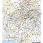
Afghanistan at 1:2,000,000 on a wall map, size 88 x 95cm (35″ x 37″ approx) ‘“ paper version, from Gizi Map, with on the reverse large street plans of Kabul with an enlargement showing its central are in greater detail, plus Kandahar, Herat, Jalalabad, Kunduz and Mazar-e Sharif.On one side is a map of Afghanistan and the whole of Pakistan at 1:2,000,000. Bold altitude colouring clearly shows the physical geography of the two countries and the surrounding region, with plenty of spot heights and names of mountain and hill ranges, deserts, etc. Additional graphics indicate glaciers, deserts, glaciers, swamps and salt flats.Road network shows minor roads and selected local tracks. Railway lines are included and local airports are marked. A range of symbols indicate various places of interest, including UNESCO World Heritage sites, national parks, cultural and historical sites, etc. Also marked are internal administrative boundaries within Afghanistan and Pakistan and names of the provinces. Latitude and longitude lines are drawn at 1ยฐ intervals. Map legend includes English. The index lists locations in both countries.On the reverse are large street plans of Afghanistan’s six main cities: Kabul, Kandahar, Herat, Jalalabad, Kunduz and Mazar-e Sharif. The plans show each city’s administrative division into districts, with plenty of names of local neighbourhoods. Main and important smaller streets are named and principal traffic arteries are highlighted. A range of symbols highlight various places of interest, including selected hotels, cultural and educational institutions, UN organizations and foreign embassies, etc. Kabul is covered on maps: the city with its outer districts including the international airports at 1:35,000, with relief shading and spot heights clearly showing the city’s unique topography, plus a detailed enlargement of the central area at 1:20,000. The plans of the other five cities are at 1:25,000.* This title is also available as a folded map.

Related Products:
 Afghanistan – Kabul & 5 Cities Gizi Map
 Kabul & Historic Khyber Pass ITMB
 Afghanistan and Pakistan NGS Classic Wall Map PAPER
 Farewell Kabul: From Afghanistan to a More Dangerous World
 Afghanistan Nelles Map
 Uzbekistan Gizi Map Wall Map
 Congo Cities Map (10 Street Plans)
Turkmenistan Gizi Wall Map
Congo Cities Map (10 Street Plans)
Turkmenistan Gizi Wall Map
 Syria Gizi Wall Map
 Afghanistan ITMB
 Afghanistan F&B
 Tajikistan – The Pamirs Gizi Map Wall Map
 Uzbekistan Gizi Map
 Pakistan Gizi Map
 Mexico: Ed. Independecia State Road Maps and Street Plans
 Montenegro & North Albania Gizi Wall Map
 Turkmenistan Gizi Map
 Stanford`s New Map of Kabul (1880) – A3 Wall Map, Canvas
Stanford`s New Map of Kabul (1880) – A2 Wall Map, Canvas
Stanford`s New Map of Kabul (1880) – A3 Wall Map, Canvas
Stanford`s New Map of Kabul (1880) – A2 Wall Map, Canvas
 Syria Gizi Map
Stanford`s New Map of Kabul (1880) – A3 Wall Map, Paper
Stanford`s New Map of Kabul (1880) – A2 Wall Map, Paper
Stanford`s New Map of Kabul (1880) – A1 Wall Map, Canvas
Syria Gizi Map
Stanford`s New Map of Kabul (1880) – A3 Wall Map, Paper
Stanford`s New Map of Kabul (1880) – A2 Wall Map, Paper
Stanford`s New Map of Kabul (1880) – A1 Wall Map, Canvas
 Cables From Kabul
Stanford`s New Map of Kabul (1880) – Original Size Wall Map, Paper
Cables From Kabul
Stanford`s New Map of Kabul (1880) – Original Size Wall Map, Paper
 Silk Road Countries Wall Map
 Somalia Gizi Map
Stanford`s New Map of Kabul (1880) – A1 Wall Map, Paper – Print on Demand
Somalia Gizi Map
Stanford`s New Map of Kabul (1880) – A1 Wall Map, Paper – Print on Demand
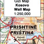 Kosovo Gizi Wall Map
 Kyrgyzstan Gizi Map
Tajikistan – The Pamirs Gizi Map
Kyrgyzstan Gizi Map
Tajikistan – The Pamirs Gizi Map
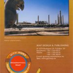 Iran Gizi Map
Kazakhstan Political Gizi Map
Iran Gizi Map
Kazakhstan Political Gizi Map
 Middle East Gizi Map
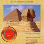 Egypt Gizi Map
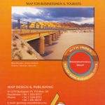 Algeria Gizi Geographical Map
 Morocco Gizi Map
 Bulgaria (with Street Plans of Black Sea Resorts)
 Kazakhstan Geographical Gizi Map