Disclosure : This site contains affiliate links to products. We may receive a commission for purchases made through these links.
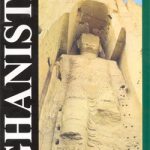
Afghanistan ITMB
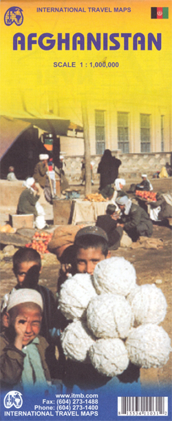
Afghanistan at 1:1,000,000 on a double-sided indexed map from ITMB, with large, clear street plans of central Kabul and Kandahar. Altitude colouring shows the topography and coverage extends to the North-West Frontier province of Pakistan and its Federally Administered Tribal Areas adjoining the eastern part of Afghanistan.The map clearly shows the country’s administrative divisions with names of the provinces. Elevation colouring and altitude for mountain passes are in feet (although the elevation of the Khyber Pass is given in metres). Graphics also indicate swamps and salt flats. The map shows the country’s road and rail networks, including selected 4WD tracks and trails, and marks local airports. Places of historical or geographical interest are highlighted, including the course of the Silk Route. The map is indexed and has latitude and longitude lines at intervals of 1ยฐ. Also provided are large, clear street plans of central Kabul and Kandahar, highlighting main governmental and municipal institutions, UN offices, selected accommodation, main sights, etc.

Related Products:
 Afghanistan – Kabul & 5 Cities Gizi Map
 Afghanistan – Kabul & 5 Cities Street Plans Gizi Wall Map
 Afghanistan Nelles Map
 Malawi & Mozambique ITMB
 Afghanistan F&B
 Angola ITMB
 Australia ITMB
 Chile ITMB
 Mexico ITMB
 Romania & Moldova ITMB
Kabul & Historic Khyber Pass ITMB
Romania & Moldova ITMB
Kabul & Historic Khyber Pass ITMB
 Peru ITMB
Zambia & Eastern Africa ITMB Road Map
Sri Lanka & India South ITMB
Peru ITMB
Zambia & Eastern Africa ITMB Road Map
Sri Lanka & India South ITMB
 Colombia ITMB
 Namibia ITMB
Malta & Gozo ITMB
Namibia ITMB
Malta & Gozo ITMB
 Argentina North & Uruguay ITMB
 Afghanistan
 Malaysia ITMB
 Lima & Central Peru ITMB
 Mongolia ITMB
 Bhutan & Northeast India ITMB
 Cuba ITMB
 Morocco ITMB
 Iran & Tehran ITMB
 Alberta ITMB
 Belarus ITMB
 Thailand ITMB
 Madagascar ITMB
 Albania ITMB
 Zurich & Switzerland NW ITMB
 Santiago & Chile North ITMB
 Togo & Benin ITMB
 California ITMB
 Middle East ITMB Travel Atlas
 Bangladesh & India East ITMB
 Africa ITMB
Lebanon & Beirut ITMB
Africa ITMB
Lebanon & Beirut ITMB