Disclosure : This site contains affiliate links to products. We may receive a commission for purchases made through these links.
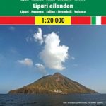
Aeolian (Lipari) Islands Global Map Tourist Map

Aeolian (Lipari) Islands on a detailed map from Litografia Artistica Cartografica with street plans of Lipari Town and Canneto. The main group: Vulcano, Lipari and Salina are shown together, with the remaining islands including Stromboli on insets. The map, now available with new updated cartography, provides good presentation of the islands’ topography, with contours at 50m intervals enhanced by relief shading, plus names of various geographical features. In addition to showing local roads and mule tracks, the map also indicates hiking paths, including trails to peaks such as Pizzo Sopra La Fossa on Stromboli. Symbols highlight various places of interest: campsites and tourist villages, surfing and diving locations, caves, etc. Also marked are ferry connections between the islands or with the mainland and Sicily. The map has no geographical coordinates.On the reverse are street plans of Lipari Town and Canneto highlighting accommodation and places of interest, plus notes on the archipelago’s geography and lists of useful addresses including various types of accommodation. Map legend and the notes include English.Also provided is a road map at 1:800,000 showing the north-western coast of Sicily with Palermo and the adjoining mainland with Reggio di Calabria and Vibo Valentia.

Related Products:
 Aeolian (Lipari) Islands and Southern Italy F&B
 Aeolian (Lipari) Islands Kompass 693
 Monti Iblei – South-Eastern Sicily Global Map Tourist Map
 Virgin Islands Borch
 Capri Global Map Tourist Map
 Venice (with the Islands and the Lido) Global Map Street Plan
 Lofoten and Vesteralen Islands
 Cayman Islands & Jamaica ITMB
 Sicily – 46 Walking Routes Including Mt Etna and the Egadi and Aeolian Islands
 Virgin Islands (US and British) ITMB
 Sorrento Peninsula – Amalfi Coast – Capri Global Map Tourist Map
 Okinawa & the Ryukyu Islands Periplus Travel Map
 Elba Global Map Tourist Map
 Orkney – Shetland Islands Leisure and Tourist Map
 Falkland Islands Explorer
 Hawaiian Islands
 Costa degli Dei – Tropea – Vibo Valentia Global Map Tourist Map
 Greece & the Islands Marco Polo Map
 Lake Bracciano – Monti della Tolfa – Civitavecchia Global Map Tourist Map
 Virgin Islands (US and British)
 Polynesian Islands ITMB Travel Atlas
 Maremma – Grossetana Global Map Tourist Map
 Hawaiian Islands Borch
 Latgale South Jana Seta Tourist Map
 Corfu Orama Editions 302
 Kurzeme South Jana Seta Tourist Map
 Central Latvia Jana Seta Tourist Map
 Marsala Global Map Street Plan
Kurzeme North Jana Seta Tourist Map
Marsala Global Map Street Plan
Kurzeme North Jana Seta Tourist Map
 Northland: Whangarei, Bay of Islands and 61 Provincial Towns Pathfinder
 Vidzeme North Jana Seta Tourist Map
 Sorrento Global Map Street Plan
 Vidzeme East – Latgale North Jana Seta Tourist Map
 Danube Bend Cartographia Tourist Map 31
 Lima Tourist Plan
 Carpathians Kartografija Tourist Map ENGLISH
 Samos & Northern Dodecanese Islands 50K Kompass Map No.253
 Lago di Bolsena Global Map Tourist Map
 ร–land
 Faroe Islands