Disclosure : This site contains affiliate links to products. We may receive a commission for purchases made through these links.
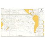
Admiralty Routeing Chart 5128(9) – S Pacific – September
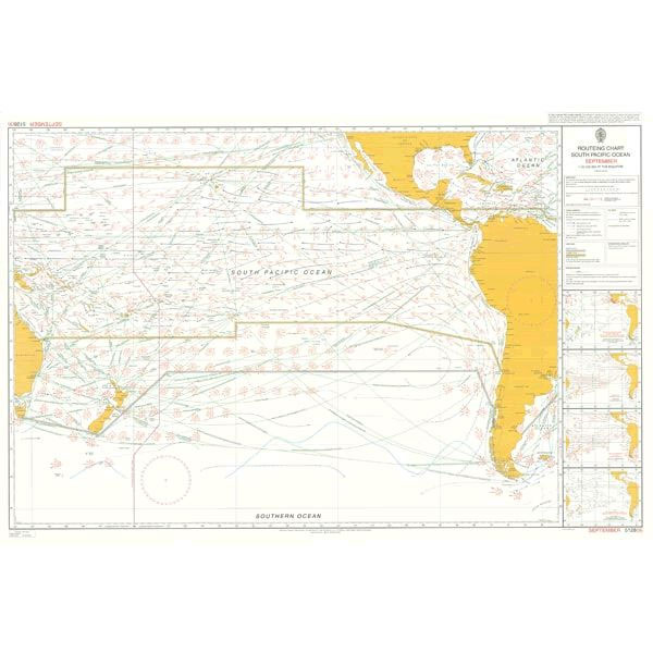
Essential for use in passage planning for ocean voyages, Routeing Charts include routes and distances between major ports, ocean currents, ice limits, load lines and wind roses. They also contain expected meteorological and oceanographic conditions for each month of the year.Individual chart scales of 1:5,000,000, 1:10,000,000 and 1:20,000,000 assist bridge crews in high-level route planning.Information including wind roses showing wind speed and direction, the frequency and intensity of storms and low pressure, ocean currents, sea and air temperatures, air pressure and ice limits based on data averages is available on Routeing Charts.Each charted area contains 12 separate charts for each calendar month, covering meteorological and oceanographic conditions that change throughout the year.

Related Products:
 Admiralty Routeing Chart 5128(5) – S Pacific – May
 Admiralty Routeing Chart 5128(11) – S Pacific – November
 Admiralty Routeing Chart 5128(12) – S Pacific – December
 Admiralty Routeing Chart 5128(1) – S Pacific – January
 Admiralty Routeing Chart 5128(2) – S Pacific – February
 Admiralty Routeing Chart 5128(3) – S Pacific – March
 Admiralty Routeing Chart 5128(4) – S Pacific – April
 Admiralty Routeing Chart 5128(6) – S Pacific – June
 Admiralty Routeing Chart 5128(7) – S Pacific – July
 Admiralty Routeing Chart 5128(8) – S Pacific – August
 Admiralty Routeing Chart 5127(9) – N Pacific – September
 Admiralty Routeing Chart 5128(10) – S Pacific – October
Admiralty Routeing Chart 5146(9) – Mediterranean and Black Seas Routeing Chart – September
Admiralty Routeing Chart 5126(9) – Indian Ocean – September
Admiralty Routeing Chart 5147(9) – Arabian and Red Sea – September
Admiralty Routeing Chart 5148(9) – Bay of Bengal – September
Admiralty Routeing Chart 5124(9) – N Atlantic – September
Admiralty Routeing Chart 5149(9) – South China Sea – September
Admiralty Routeing Chart 5150(9) – East China Sea – September
Admiralty Routeing Chart 5127(5) – N Pacific – May
Admiralty Routeing Chart 5142(9) – Gulf of Mexico and Caribbean Sea – September
Admiralty Routeing Chart 5127(2) – N Pacific – February
Admiralty Routeing Chart 5127(1) – N Pacific – January
Admiralty Routeing Chart 5127(3) – N Pacific – March
Admiralty Routeing Chart 5127(4) – N Pacific – April
Admiralty Routeing Chart 5127(6) – N Pacific – June
Admiralty Routeing Chart 5127(7) – N Pacific – July
Admiralty Routeing Chart 5127(8) – N Pacific – August
Admiralty Routeing Chart 5127(10) – N Pacific – October
Admiralty Routeing Chart 5127(11) – N Pacific – November
Admiralty Routeing Chart 5127(12) – N Pacific – December
Admiralty Routeing Chart 5141(9) – Malacca Strait to Marshall Islands – September
Admiralty Routeing Chart 5146(5) – Mediterranean and Black Seas Routeing Chart – May
Admiralty Routeing Chart 5146(1) – Mediterranean and Black Seas Routeing Chart – January
Admiralty Routeing Chart 5146(2) – Mediterranean and Black Seas Routeing Chart – February
Admiralty Routeing Chart 5146(3) – Mediterranean and Black Seas Routeing Chart – March
Admiralty Routeing Chart 5146(4) – Mediterranean and Black Seas Routeing Chart – April
Admiralty Routeing Chart 5146(6) – Mediterranean and Black Seas Routeing Chart – June
Admiralty Routeing Chart 5146(7) – Mediterranean and Black Seas Routeing Chart – July
Admiralty Routeing Chart 5146(8) – Mediterranean and Black Seas Routeing Chart – August
Admiralty Routeing Chart 5128(10) – S Pacific – October
Admiralty Routeing Chart 5146(9) – Mediterranean and Black Seas Routeing Chart – September
Admiralty Routeing Chart 5126(9) – Indian Ocean – September
Admiralty Routeing Chart 5147(9) – Arabian and Red Sea – September
Admiralty Routeing Chart 5148(9) – Bay of Bengal – September
Admiralty Routeing Chart 5124(9) – N Atlantic – September
Admiralty Routeing Chart 5149(9) – South China Sea – September
Admiralty Routeing Chart 5150(9) – East China Sea – September
Admiralty Routeing Chart 5127(5) – N Pacific – May
Admiralty Routeing Chart 5142(9) – Gulf of Mexico and Caribbean Sea – September
Admiralty Routeing Chart 5127(2) – N Pacific – February
Admiralty Routeing Chart 5127(1) – N Pacific – January
Admiralty Routeing Chart 5127(3) – N Pacific – March
Admiralty Routeing Chart 5127(4) – N Pacific – April
Admiralty Routeing Chart 5127(6) – N Pacific – June
Admiralty Routeing Chart 5127(7) – N Pacific – July
Admiralty Routeing Chart 5127(8) – N Pacific – August
Admiralty Routeing Chart 5127(10) – N Pacific – October
Admiralty Routeing Chart 5127(11) – N Pacific – November
Admiralty Routeing Chart 5127(12) – N Pacific – December
Admiralty Routeing Chart 5141(9) – Malacca Strait to Marshall Islands – September
Admiralty Routeing Chart 5146(5) – Mediterranean and Black Seas Routeing Chart – May
Admiralty Routeing Chart 5146(1) – Mediterranean and Black Seas Routeing Chart – January
Admiralty Routeing Chart 5146(2) – Mediterranean and Black Seas Routeing Chart – February
Admiralty Routeing Chart 5146(3) – Mediterranean and Black Seas Routeing Chart – March
Admiralty Routeing Chart 5146(4) – Mediterranean and Black Seas Routeing Chart – April
Admiralty Routeing Chart 5146(6) – Mediterranean and Black Seas Routeing Chart – June
Admiralty Routeing Chart 5146(7) – Mediterranean and Black Seas Routeing Chart – July
Admiralty Routeing Chart 5146(8) – Mediterranean and Black Seas Routeing Chart – August