Disclosure : This site contains affiliate links to products. We may receive a commission for purchases made through these links.
Admiralty Chart SC5608_5 – Barnstaple and Bideford
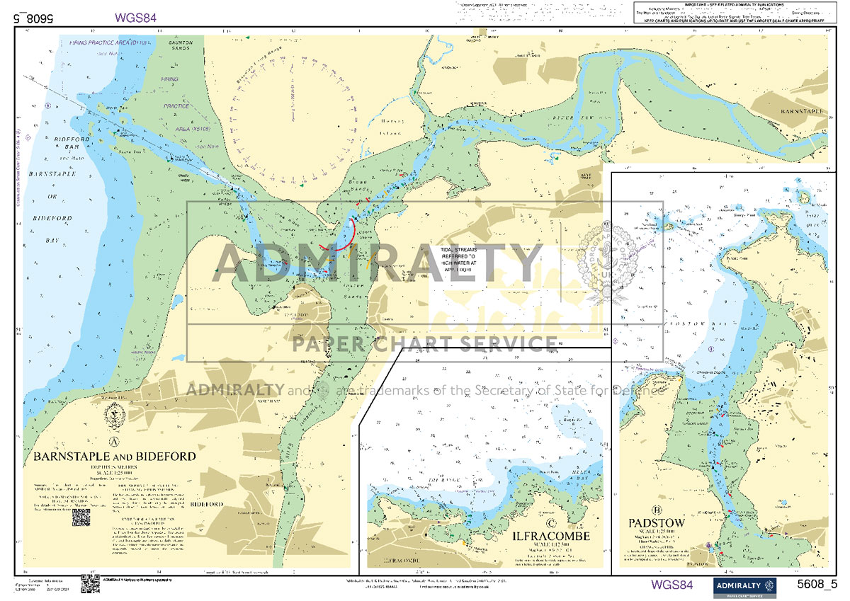
NEWAdmiralty Small Craft nautical charts comply with Safety of Life at Sea (SOLAS) regulations and are ideal for professional, commercial and recreational use. Charts within the series consist of a range of scales, useful for passage planning, coastal navigation and entering port.All Admiralty Small Craft nautical charts are A2 size, 590x420mm.This chart was previously a part of SC5608 folio.Included:A Barnstaple and Bideford.1:25,000B Padstow1:25,000C Ilfracombe1:12,500
Related Products:
 Admiralty Chart SC5608_4 – Hartland Point to Lundy and Ilfracombe
 Admiralty Chart SC5603_5 – Newquay to Padstow – Newquay – Padstow – Port Isaac
 Admiralty Chart SC5608_21 – Severn Bridge to Sharpness
 Admiralty Chart SC5608_2 – Padstow to Saint Ann’s Head
 Admiralty Chart SC5608_19 – Avonmouth Bridge to Sea Mills Creek
 Admiralty Chart SC5608_18 – Avonmouth to Severn Bridge
 Admiralty Chart SC5608_17 – Approaches to Barry and Cardiff
 Admiralty Chart SC5616_3 – Mallaig to Glenelg
 Admiralty Chart SC5608_16 – Bristol Deep to King Road
 Admiralty Chart SC5607_7 – Rivers Stour and Orwell
 Admiralty Chart SC5616_17 – Loch Hourn
 Admiralty Chart SC5602_6 – Plymouth to Salcombe – Torquay – Eddystone Rocks
 Admiralty Chart SC5603_2 – Falmouth to Penzance – Porthleven – Mullion Cove
 Admiralty Chart SC5603_15 – Falmouth to Isles of Scilly and Port Isaac to Hartland Point
 Admiralty Chart SC5609_9 – Menai Strait – Eastern Part
 Admiralty Chart SC5610_6 – Plans in the Kyles of Bute
 Admiralty Chart SC5616_4 – Loch Duich to Loch Carron
 Admiralty Chart SC5614_19 – Kingston Upon Hull to Humber Bridge
 Admiralty Chart SC5603_3 – Penzance to Saint Ives – Longships – Runnel Stone
 Admiralty Chart SC5610_4 – River Clyde
 Admiralty Chart SC5604_11 – Guernsey, Saint Peter Port – Beaucette Marina – The Casquets
 Admiralty Chart SC5617_20 – Caledonian Canal Central Part
 Admiralty Chart SC5608_7 – Swansea Bay
 Admiralty Chart SC5616_19 – Gairloch
 Admiralty Chart SC5623_6 – Harbours and Anchorages in South West Ireland
 Admiralty Chart SC5608_12 – Watchet to Barry
 Admiralty Chart SC5608_14 – Burnham-on-Sea and Approaches
 Admiralty Chart SC5611_27 – Seil Sound and Sound of Insh – Islay, Port Ellen – Jura, Loch Tarbert
 Admiralty Chart SC5605_12 – Ports in France and Belgium
 Admiralty Chart SC5609_5 – Caernarfon Bay
 Admiralty Chart SC5614_18 – Immingham to Saltend
 Admiralty Chart SC5609_2 – Aberystwyth to Barmouth
 Admiralty Chart SC5617_19 – Caledonian Canal – Northern Part and Inverness
 Admiralty Chart SC5614_22 – Bridlington to Scarborough
 Admiralty Chart SC5614_17 – Approaches to Grimsby
 Admiralty Chart SC5614_6 – Caister-On-Sea to Mundesley
 Admiralty Chart SC5611_28 – Oban – West Loch Tarbert – The Small Isles
 Admiralty Chart SC5605_6 – Hastings to Dungeness – Rye
 Admiralty Chart SC5614_2 – Lowestoft to Winterton Ness
 Admiralty Chart SC5608_13 – Barry to Stert Point


