Disclosure : This site contains affiliate links to products. We may receive a commission for purchases made through these links.
Disclosure : This site contains affiliate links to products. We may receive a commission for purchases made through these links.
Categories
-
Best Sellers
-

Hardangervidda West Nordeca 2659
The Odda ‘“ Litlos ‘“ Hรฅrteigen – Kinsarvik area in the western part of the Hardangervidda region of Norway in a series of GPS compatible recreational Read More » -

Albanchez CNIG Topo 1014-1
Topographic coverage of mainland Spain at 1:25,000 published by the Centro Nacional de Informaciรณn Geograficรก, the country’s civilian survey organization. The maps have contours at 10m Read More » -

Adam Smith: What He Thought, and Why it Matters
Adam Smith is now widely regarded as `the father of modern economics` and the most influential economist who ever lived. But what he really thought, and Read More » -

Reisbach
GPS compatible recreational maps of the Bavarian topographic survey at 1:25,000, with waymarked hiking trails and cycling routes, campsites and youth hostels, etc. Contours used in Read More » -

The Little Book of Planting Trees
From the author of The Wisdom of Trees, an informative and practical guide to tree planting: including guidance on which trees to plant and where; how Read More » -

Flat Stanley
The magical and brilliantly funny adventures of everyone`s favourite flat boy – Flat Stanley. With wonderful new illustrations by the award-winning author/illustrator Rob Biddulph. Stanley Lambchop Read More » -

Primitive Technology: The Complete Guide to Making Things in the Wild from Scratch
Disconnect from digital and reconnect with your inner caveman.Build. Cook. Hunt. Heat. Survive.Could you thrive in the wilderness?The most primitive human skills unite us all, yet Read More » -
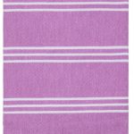
Perim Hamam Towel – Blueberry
Perim is a great all-round pestemal towel. Available in a wide range of vibrant colours. Lightweight, compact, multi-use and quick to dry so perfect for holidays Read More » -
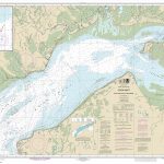
NOAA Chart 16663 – Cook Inlet’”East Foreland to Anchorage – North Foreland
NOAA maintains the nautical charts and publications for U.S. coasts and the Great Lakes. Over a thousand charts cover 95,000 miles of shoreline and 3.4 million Read More » -

Muhldorf am Inn N15
Mรผhldorf a.Inn in a series of GPS compatible recreational editions of the Bavarian topographic survey at 1:25,000, with waymarked hiking trails and cycling routes, campsites and Read More »
-


