Disclosure : This site contains affiliate links to products. We may receive a commission for purchases made through these links.
Disclosure : This site contains affiliate links to products. We may receive a commission for purchases made through these links.
Categories
-
Best Sellers
-

NOAA Chart 18471 – Approaches to Admiralty Inlet’”Dungeness to Oak Bay
NOAA maintains the nautical charts and publications for U.S. coasts and the Great Lakes. Over a thousand charts cover 95,000 miles of shoreline and 3.4 million Read More » -

The Hills of Wales
Shortlisted for the Stanford Dolman Travel Book of the Year at the Edward Stanfords Travel Writing Awards 2016.An appreciation of the hills of Wales; their character, Read More » -

The World Atlas of Whisky
Award-winning author and whisky expert Dave Broom explores over 200 distilleries and examines over 400 expressions. Detailed descriptions of the Scottish distilleries can be found here, Read More » -
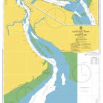
Admiralty Chart 833 – Rangoon River and Approaches
NEW EDITION OUT ON 17/09/2020Admiralty standard nautical charts comply with Safety of Life at Sea (SOLAS) regulations and are ideal for professional, commercial and recreational use. Read More » -

Path Of Blood Pa
Path of Blood tells the horrifying true story of the underground army which Osama Bin Laden created in order to attack his number one target: his Read More » -

Kos F&B
A road map with relief portrayed by hill shading and contours at 100m intervals. Main and minor roads and tracks are distinguished and driving distances are Read More » -
France: Languedoc-Roussillon: Chaulet, Mazet, Actinadas, Le Cirque Des Gens, Les Branches Gorge Du Tarn, Gorge De La Jonte, Le Boffi, Cantobre, Thaurac, Hortus Claret, Russan, Seynes, Mont Gaussier, Mouries, Orgon
The third book in the “Rockfax France” series covers the extensive and fertile climbing area west of the author`s previous guide to Haute Provence. The areas Read More » -

Among the Summer Snows: In Search of Scotland`s Last Snows
As the summer draws to a close, a few snowbeds – some as big as icebergs – survive in the Scottish Highlands. Christopher Nicholson`s Among the Read More » -

Nottingham – Vale of Belvoir OS Explorer Active Map 260 (waterproof)
Nottingham and the Vale of Belvoir area on a detailed topographic and GPS compatible map No. 260, waterproof version, from the Ordnance Survey’s 1:25,000 Explorer series.MOBILE Read More » -
Arthur`s Pass
Arthur`s Pass area at 1:65,000 in a series of contoured and GPS compatible maps from NewTopo NZ Ltd, with exceptionally vivid presentation of the terrain, routes Read More »
-


